Hello everyone,


I am currently training in remote sensing.


Is it possible to calculate the overlap rate between each pair of images, in the longitudinal direction and in the direction transverse to the flight axes via the FME software?


I have tried many manipulations via the "AreaOnAreaOverlayer" transformer, but it does not allow me to differentiate between the longitudinal and transverse directions.

I am open to any ideas.


With kind regards,

Hi @dozhwal​,

If you know the flight line angle, I would recommend using the Rotator transformer to rotate by the inverse of that angle around a common point before overlaying. This makes it easy to calculate the overlaps.

If you don't know the flight line angle, and you images are non-square, you can use the CenterlineReplacer to extract centerlines from the image boundaries, then calculate the angle from the start and end points.


Hello, thank you for your answer!


The purpose of my FME script is to check the longitudinal and transversal overlap rate for each image following flight line, for a project that has already been done. 


To do this, I have a SHP file (Footprint) with all the boxes representing the right-of-way of each image. In the attributes, I have the image number and the flight line number.

I also have a SHP file (Shot_number) with the center of the images. In the attributes, I also have the image number and the corresponding flight line number.


I can't understand why the flight axis angle can be relevant for my case.


I hope I was clear in my explanations, thank you very much!


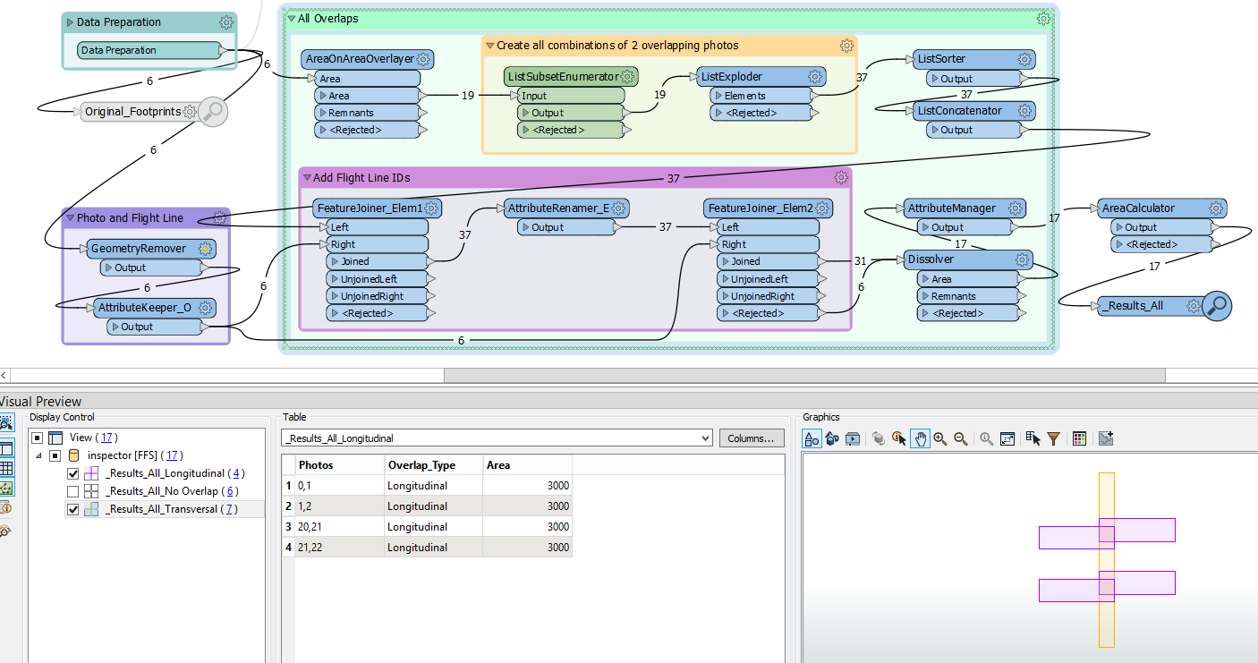
Calculating the overlap in longitudinal direction is not too difficult with the AreaOnAreaOverlayer, when you use the flight line ID as Group By attribute.

The transversal overlap is more complex. But while working on it, I realised that the calculation of both overlaps can be combined. This idea can be viewed in the attached workspace.

Footprint_Overlap_Long_Trav

Great, thanks to you!

I will look at the script in detail tomorrow!

Good evening


Calculating the overlap in longitudinal direction is not too difficult with the AreaOnAreaOverlayer, when you use the flight line ID as Group By attribute.

The transversal overlap is more complex. But while working on it, I realised that the calculation of both overlaps can be combined. This idea can be viewed in the attached workspace.

Footprint_Overlap_Long_Trav

Hello,

I wanted to thank you because your script helped me a lot!


Calculating the overlap in longitudinal direction is not too difficult with the AreaOnAreaOverlayer, when you use the flight line ID as Group By attribute.

The transversal overlap is more complex. But while working on it, I realised that the calculation of both overlaps can be combined. This idea can be viewed in the attached workspace.

Footprint_Overlap_Long_Trav

You're welcome, I am glad I could help you!


Hello, I'm coming back to you concerning the overlap rates. Indeed I realized a script which works rather well for the calculations of the horizontal (front/back) and vertical (left/right) overlapping rates. 


But, as soon as the plane makes a half turn, and changes of axis of flights, my vertical overlapping rates (left/right) are reversed...


I would like the turn to be taken into account in the script for each change of flight axis. But I don't really know how to do it...


I am open to any ideas that would allow me to unblock. 

Thank you in advance. 


Reply