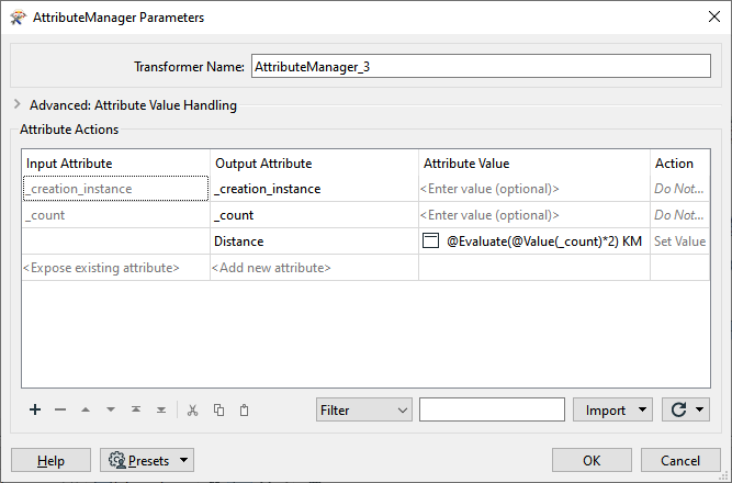
I am trying to automate creation of highway markers along a highway line feature class. I have been able to create the points along the highways at the correct interval (Using the DistanceMarker transformer) but I can't figure out how to apply the correct distance along that line (in Kms) to the newly created points. Ie. 2km, 4km, 6km, etc. in an attribute for the new point features.

Solved
How can I create distance markers along a road/highway line feature at a regular interval and apply the correct distance along the line to each point?


 +1
- Contributor
Best answer by ebygomm
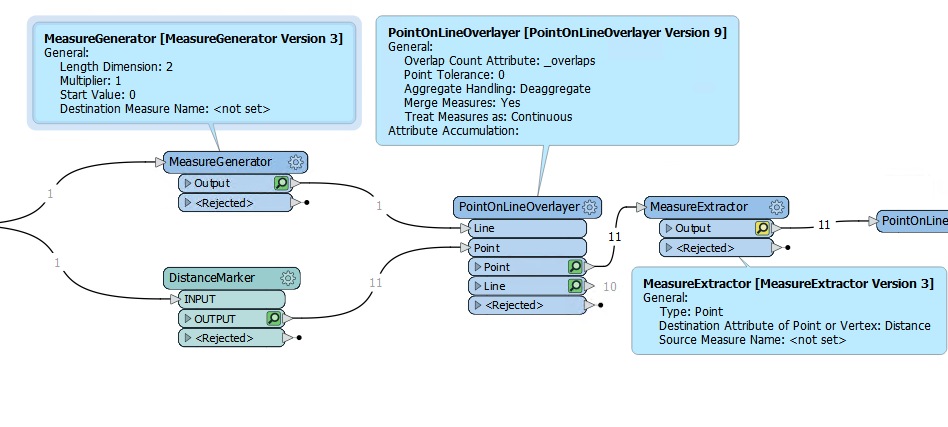
If you already have your points you need this sort of workflow to apply the correct measure to the points and then extract the measure
This post is closed to further activity.
It may be an old question, an answered question, an implemented idea, or a notification-only post.
Please check post dates before relying on any information in a question or answer.
For follow-up or related questions, please post a new question or idea.
If there is a genuine update to be made, please contact us and request that the post is reopened.