
Solved
Hi everyone, I've got to convert waypoint files to GPX files. I also need to convert txt to GPX. Please let me know if there is a work instruction for either conversion. Kind Regards, David
Hi everyone, I've got to convert waypoint files to GPX files. I also need to convert txt to GPX. Please let me know if there is a work instruction for either conversion.
Kind Regards,
David
Best answer by hkingsbury
I cannot add the WPT. file But this is the same version in txt.
Have a look at the attached .fmw
Reads in the text file using a text file reader (could also use CSV reader if there was a header line) then splits each row into each attribute (splits on a comma) then assigns the list element to an attribute (just lat/long in the example) then creates a point and writes it to gpx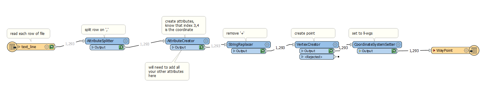
This post is closed to further activity.
It may be an old question, an answered question, an implemented idea, or a notification-only post.
Please check post dates before relying on any information in a question or answer.
For follow-up or related questions, please post a new question or idea.
If there is a genuine update to be made, please contact us and request that the post is reopened.


Login to the community
No account yet? Create an account
An FME Account is required to contribute
LoginEnter your E-mail address. We'll send you an e-mail with instructions to reset your password.