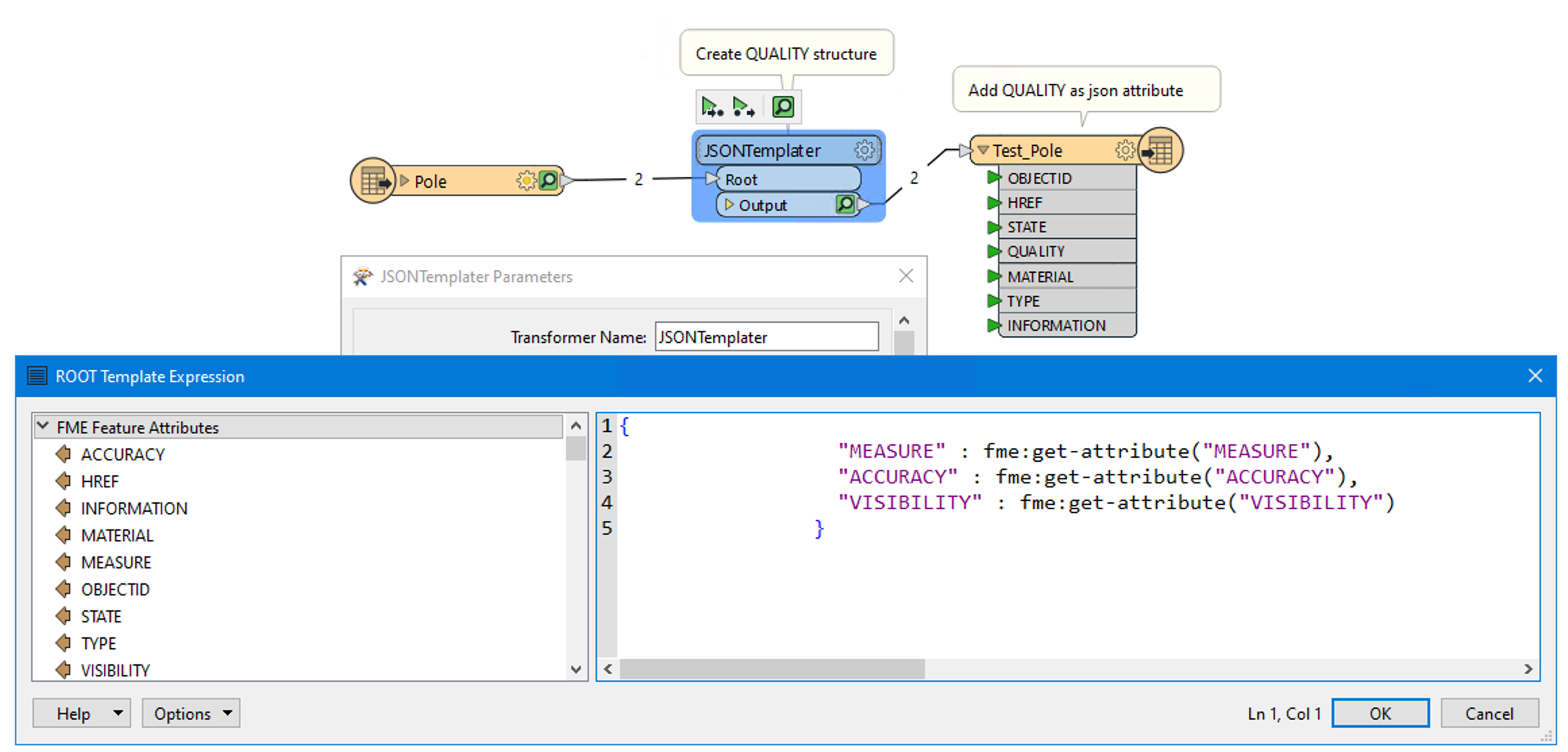
Running the attached translator : Test_Pole_geodatabase_file2geojson.fmw, returns the attached Test_Pole.json, but I need the attributes: MEASURE, ACCURACY, VISIBILITY to be nested under a new "QUALITY" attribute. The translator returns this:
{
	"type" : "FeatureCollection",
	"name" : "Test_Pole",
	"features" : [
		{
			"type" : "Feature",
			"geometry" : {
				"type" : "Point",
				"coordinates" : [ 5.0735809934, 60.6100338064, 36.882 ]
			},
			"properties" : {
				"OBJECTID" : 1,
				"HREF" : "foot",
				"STATE" : "existing",
				"MEASURE" : 99,
				"ACCURACY" : 500,
				"VISIBILITY" : 40,
				"MATERIAL" : "metall",
				"TYPE" : "high voltage",
				"INFORMATION" : "Example of high voltage"
			}
My goal is to achieve this:
{
	"type" : "FeatureCollection",
	"name" : "Test_Pole",
	"features" : [
		{
			"type" : "Feature",
			"geometry" : {
				"type" : "Point",
				"coordinates" : [ 5.0735809934, 60.6100338064, 36.882 ]
			},
			"properties" : {
				"OBJECTID" : 1,
				"HREF" : "foot",
				"STATE" : "existing",
				"QUALITY":{
				  "MEASURE" : 99,
				  "ACCURACY" : 500,
				  "VISIBILITY" : 40,
				},
				"MATERIAL" : "metall",
				"TYPE" : "high voltage",
				"INFORMATION" : "Example of high voltage"
			}
Any suggestions (or maybe solutions :) would be much appreciated.


 I am attaching the updated workspace for you.