Question

Get Corner Coordinates of pixels with color

  • March 20, 2023
  • 1 reply
  • 11 views

Hello,


i need to georeference 800 maps.

Every map is from a grid that is 1km x 1km.

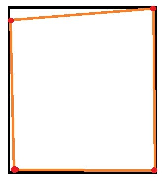
From the Scanning and the old paper it can be that the Map has a angle just like showing in the example picture below.


Is it possible to get the coordinates of the 4 Red points and set them to the coordinates that the Picture should have from the grid?


I know how to do it with the bounding box but i dont know how to deal with the transparency.


or is there a better way to make the georeferencing of 800 picutres more easy?


Example

1 reply

daveatsafe
Safer
Forum|alt.badge.img+19
  • Safer
  • March 20, 2023

Hi @fluusha​,

The RasterExtentsCoercer transformer may be helpful here, if you use the Data Extents option. This will give you the bounding polygon around the non-transparent area of the raster.


Reply


Cookie policy

We use cookies to enhance and personalize your experience. If you accept you agree to our full cookie policy. Learn more about our cookies.

 
Cookie settings