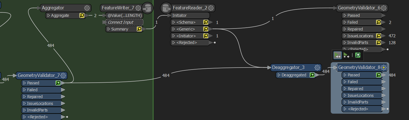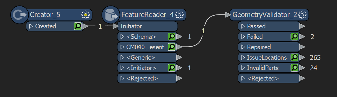
Can anyone please explain why with only 1 feature being read, more than 1 can fail? Any help would be highly appreciated!
Many thanks!!

 +4
+4
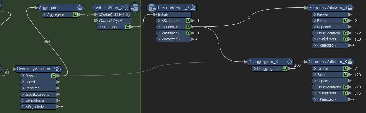
Can anyone please explain why with only 1 feature being read, more than 1 can fail? Any help would be highly appreciated!
Many thanks!!
No account yet? Create an account
Enter your E-mail address. We'll send you an e-mail with instructions to reset your password.