


Hello!
I have shp footprint of buildings and DEM information with TIFF format. I would like to extract Band0 value as a height information, and then apply it into footprint, so then I can create a 3D buildings. Could you tell me the flow that I have to use? maybe I also have to change the coordinate system right

")

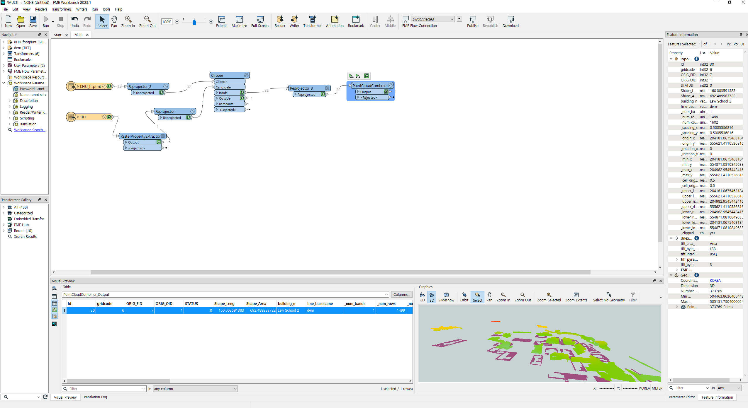 hello, I created the pointcloud and it seems like every points has their own Z value(height), could you help me to create a building base on each height of the point?
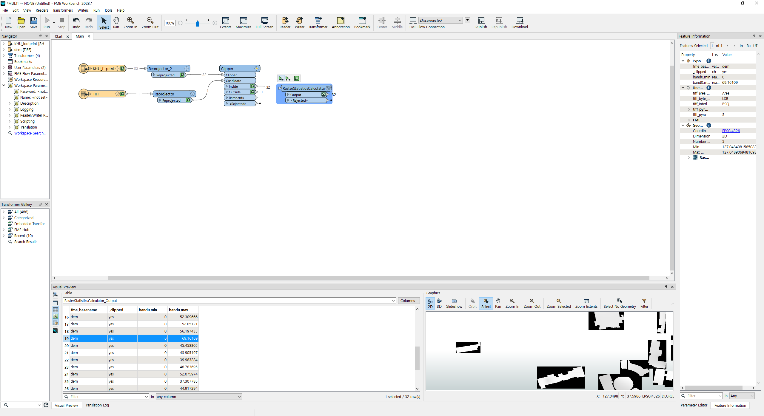 And I also tried to make 2.5D objects, and because of the black area of clipped raster(which has 0 value) all the min values are 0. I wanted to use mean as a elevation value, but because of this problem, I think I cannot use mean, also if the terrain is higher than other area, Z mean values of those buildings are higher, it doesn't represent the height well. Thank you for your reply!
 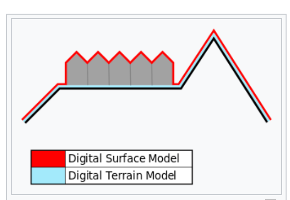 To create a height map of just the objects on the surface, you need to subtract the DTM (surface values) from the DSM (surface + object values). This leaves you with a raster of just the height of the objects.