Hi,
It's not entirely clear whether this has been solved or not already. I'm using FME 2022.1.
I have a portal feature service with has jpegs as attachments.
I want to read the exif metadata from the blobs.
jpeg_exif_gpslatitude jpeg_exif_gpslongitude jpeg_exif_gpsimgdirection
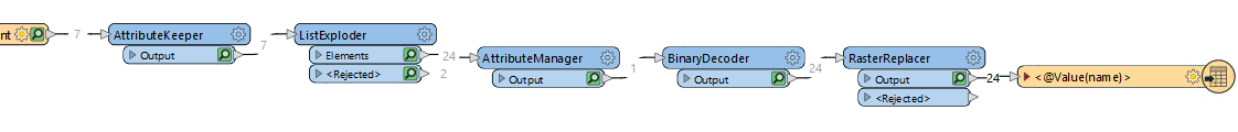
If I use the RasterReplacer method I lose all exif metadata.
Best answer by nielsgerrits
peteratqfes wrote:
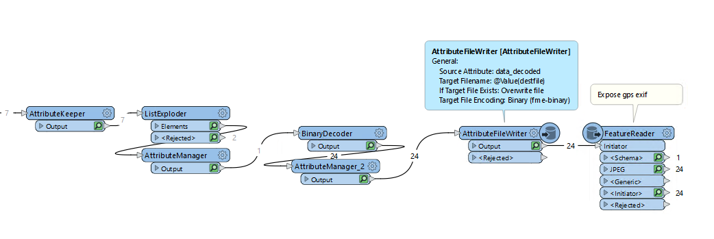
Maybe I'm answering my own problem below - always the way where you post your question and find the answer a few minutes later.
BUT is there any way of obtaining exif data without writing out to files? blob to exif direct?
My method below wrote blob binary encoded out to file using the AttributeFileWriter and using a FeatureReader with the exif gps data exposed. Works.
I think this is as good as it gets. One optimization can be using a TempPathnameCreator to prevent the need to clean the files afterwards.
View original