Question

Extract geometry from pdf and preserve geometry dimentions

  • 17 December 2023
  • 14 replies
  • 30 views

Badge +6

Hi,


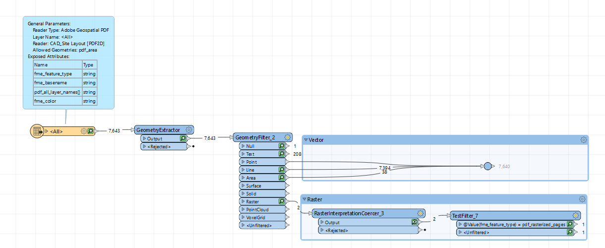
I have a pdf from which I can split into vector data (points, lines, polygons) and raster (pdf_rasterized_pages). I know the paper size of the pdf (A1) and scale (1:500). I would like to save the vector data in gdb and preserve lenght, area and position of the shapes. In general, once the shapes are opened in ArcPro they should have the same geomety and dimentions as on the printed on A1 paper.


I have tried scaler but the outcome did not match printed pdf.

image 


14 replies

Userlevel 4
Badge +17

What is your outcome and what is your expected outcome?

Badge +6

What is your outcome and what is your expected outcome?

Vector data with the measurements that match features visible on pdf after applying scale

Userlevel 5
Badge +36

Maybe your PDF is not a Geospatial PDF, even though it contains a map.

A Geospatial PDF contains georeferencing metadata, which should make it possible to extract all data without rescaling or repositioning the data.

Badge +6

This may be the case. However, I think there has to be a way around it. I was thinking of finding a way to save the geometry from pdf to scale. In general each pdf has specified paper (eg A1)size and scale. When the map is printed, the geoemtry visible on the map has given length. I would like to be able to extract the geometry with exactly the same length visible on printed A1 map. To be able to do that the pdf does not have to be georeferenced

Userlevel 5
Badge +36

This may be the case. However, I think there has to be a way around it. I was thinking of finding a way to save the geometry from pdf to scale. In general each pdf has specified paper (eg A1)size and scale. When the map is printed, the geoemtry visible on the map has given length. I would like to be able to extract the geometry with exactly the same length visible on printed A1 map. To be able to do that the pdf does not have to be georeferenced

Yes, there certainly is a way around it.

You would have to transform (move, scale and maybe rotate) the data. For that you would have to know some properties of the data you extract from the PDF, and the corresponding real data.

Paper size and map scale may be of interest, but it would probably be better if you could use coordinates.

FME has many transformers that may be of use here: Affiner, Scaler, Offsetter, Rotator, and more.

Userlevel 5
Badge +26

For a non-georeferenced PDF FME creates an arbitrary, page-based, coordinate system. The units of that system are typographic points, 1 point being 0.3527777778 mm

Badge +6

For a non-georeferenced PDF FME creates an arbitrary, page-based, coordinate system. The units of that system are typographic points, 1 point being 0.3527777778 mm

Is there a documentation on how to do it?

Userlevel 5
Badge +26

Is there a documentation on how to do it?

Can you be a bit more clear about what exactly you want as output? You say: "In general, once the shapes are opened in ArcPro they should have the same geomety and dimentions as on the printed on A1 paper.", the way I see it, they do as long as you can convince ArcPro it's a legit coordinate system (and I'm not nearly ESRI expert enough to say something meaningful about that).

Badge +6

Is there a documentation on how to do it?

Extracted from pdf geometry saved in gdb has different dimention once added to ArcPro (even if correct coordinate system is assigned). The geometry should look like that image
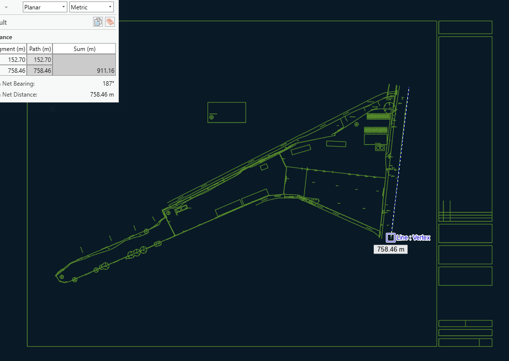
Lenght of selected line should be 130.66m.
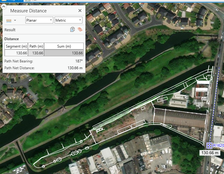
The geometry extracted from pdf is located in 0,0 position and the length of the same line is 758.46m . Map is A1, scale 1:500image

Userlevel 5
Badge +26

Is there a documentation on how to do it?

What's the length the FME Data Inspector shows?

Badge +6

Is there a documentation on how to do it?

image.png

Userlevel 5
Badge +26

Is there a documentation on how to do it?

Okay, so that would be 317 pts, about 110 mm.

Are you sure the scale is 1:500, because based on this I wouldn't be so sure.

Badge +6

Is there a documentation on how to do it?

it is definiviely 1:500

Is there a documentation on how to do it?

Thanks for the info.


Thanks for the info, I appreciate you. I was searching for the dissertation service online and I found them over https://academized.com/dissertation-writing-service here and while searching for it online, I found your post link as well. I want to extract geometry from pdf and preserve geometry dimentions but I don't know how can I do it and that is why I took interest in your post and I am so glad I found my answer over here.

Reply