So I'm trying to reproject the data in a DWG file from one projection using the ETRS89 datum (ETRS89 / NTM zone 11 [EPSG:5111]) to another (ETRS89 / UTM zone 32N [EPSG:25832]). I've set up a feature reader to read using the RealDWG reader to a single output port. I've set up a RealDWG writer from that same port, writing to a different coordinate system.  I've tried three different versions of this: One without any projector transformer, just writing to a different CRS, one with the PROJReprojector and one with the Reprojector transformer. As far as I can see the results look the same from all three.
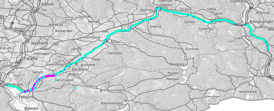
The input data is located nicely along a corridor as seen in the inspector:
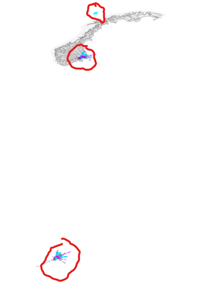
 In the output file I have data in three clusters:
 The southern one contains some of the original data in the original coordinate system. They are not transformed at all! The middle one contains some of the original data transformed correctly to the new CRS. The northern cluster contains a smaller subset of data that seem to be transformed wrong.
Now, the objects in the two "off" clusters look to be duplicates, as the correctly transformed cluster contain the same objects.
Anyone have suggestions here?


