Hello,


I have an excel sheet with Lon Lat values and I'm trying to convert them to points and then place them on a map that is in EPSG3857, however, the points don't land where they should be. I write it to a shapefile. Any help would be much appreciated.
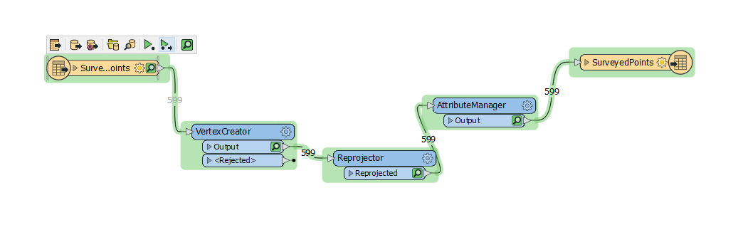
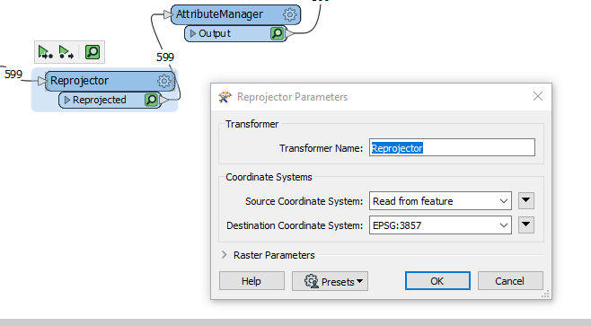
image_workbench image_workbench2 

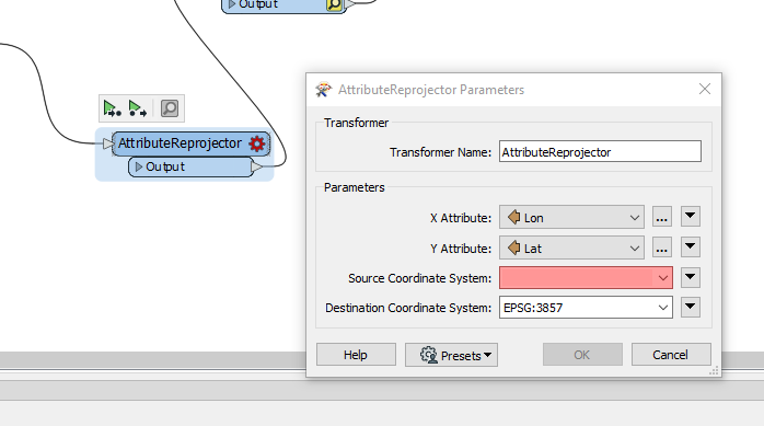
I've also tried the AttributeReprojector but what do I select for the Source Coordinate System if it's coming from Lon Lat values? I did not find GCS_WSG_1984.
image_workbench3The LON values are displayed without the -, sample: 114.2563, how can I add a dash to makes it -114.2563?


You need to set the source coordinate system. It's EPSG:4326


You need to set the source coordinate system. It's EPSG:4326

Thanks for your reply @nielsgerrits​ 

The LON values are displayed without the -, sample: 114.2563, how can I add a dash to make it -114.2563?


Thanks for your reply @nielsgerrits​ 

The LON values are displayed without the -, sample: 114.2563, how can I add a dash to make it -114.2563?


You can do this in the VertexCreator, x = @Evaluate(LON*-1)


Thanks for your reply @nielsgerrits​ 

The LON values are displayed without the -, sample: 114.2563, how can I add a dash to make it -114.2563?


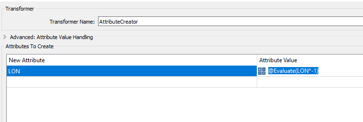
I tried the following but the results are Null values for the new LON field

sampleImageFME


Thanks for your reply @nielsgerrits​ 

The LON values are displayed without the -, sample: 114.2563, how can I add a dash to make it -114.2563?


 x = @Evaluate(Lon*-1)


This gives me errors when I run the workbench


Thanks for your reply @nielsgerrits​ 

The LON values are displayed without the -, sample: 114.2563, how can I add a dash to make it -114.2563?


Oops, my bad, needs to be @Evaluate(@Value(LON)*-1)


Reply