


I'm trying to clip some DSM's in geotiff format to a specific boundary. These geotiffs are elevation grids so they aren't multiple bands, instead they are just filled with elevation values.
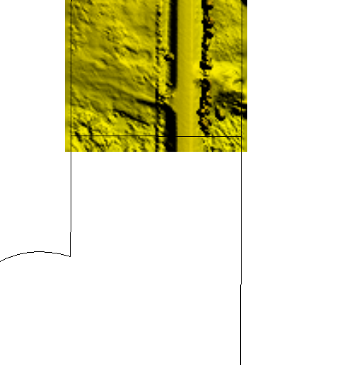
I'm currently reading them in as geotiff's and trying to clip using the clipper transform however I keep running into a problem. The first is that I'm getting two outputs because the geotiff extends into another clippee section. See below:
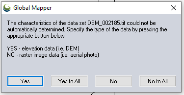
My last issue, which is a bit minor is that the exported TIFF headers don't say that the raster is filled with elevation grid data. I have to confirm when importing into any other software. See below:
Any help or advice is much appreciated.

