
")

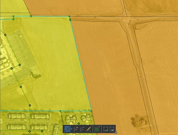
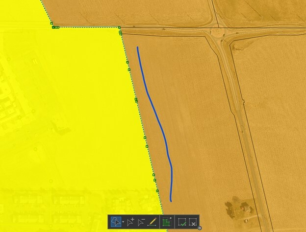
I am trying to utilize the Anchored Snapper to snap the edge of a zoning area to the underlying parcel boundaries. The tool visually works great; however, it is utilizing the vertices of both features resulting in overlaps and slivers that are later detected in our workflow. Is there a means to have the Anchored Snapper only utilize the vertexes of the anchor? Is there a better tool option that will not change the parcel feature?

Question
Anchored Snapper - Use only the vertices of the anchor.
")


Login to the community
No account yet? Create an account
An FME Account is required to contribute
LoginEnter your E-mail address. We'll send you an e-mail with instructions to reset your password.