Hi all,
I'm having a simple question about using the Red-Green-Blue (RGB-) values from point clouds. I have a LAS-file, which is already coloured and does display the RGB-values when I open the LAS-file in the FME Data Inspector.
However, it seems impossible to use those values in any kind of calculator. I have a GIS-background, and I am used to a strict vector/raster data separation. It seems like a LAS-file is read as a raster, although it can contain multiple points per [xy]-value (e.g. walls, tree stems).
I want to use the RGB-values that are already in de point properties. I see how I can keep them (e.g. PointCloudPropertyExtractor), but there seems to be no way to use these properties in any kind of calculation tool.
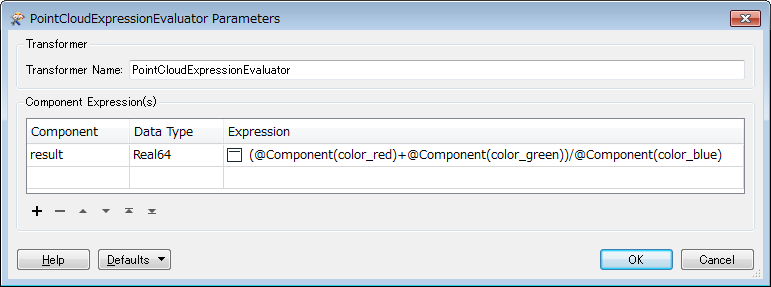
The reason why I want to do this, is because I want to filter some points out based upon the ratio (R+G)/B.
Suggestions are welcome :)
Thanks in advance,
Martin


