Is it possible to get an additional attribute from a las file in FME. Indeed I have an input point cloud in las format with a vertical distance attribute on each point.
I need this attribute to make statistics.
How to get this attribute directly when reading the las file (or other) without passing "PointCloudCoercer"?
Best answer by nielsgerrits
Added a sample workspace demonstrating this.
I think you need to add the PointCloudStatisticsCalculator downstream of the reader in your printscreen, manually add the Component "Distance" in the Statistics to Calculate and check the statistics you need.
If this is not what you need I did not understand your original question correct.
This post is closed to further activity.
It may be an old question, an answered question, an implemented idea, or a notification-only post.
Please check post dates before relying on any information in a question or answer.
For follow-up or related questions, please post a new question or idea.
If there is a genuine update to be made, please contact us and request that the post is reopened.
If a lasfile has an extra component like "vertical distance", you can just read the file and use the PointCloudStatisticsCalculator to calculate the statistics for the addicional component "vertical distance".
If a lasfile has an extra component like "vertical distance", you can just read the file and use the PointCloudStatisticsCalculator to calculate the statistics for the addicional component "vertical distance".
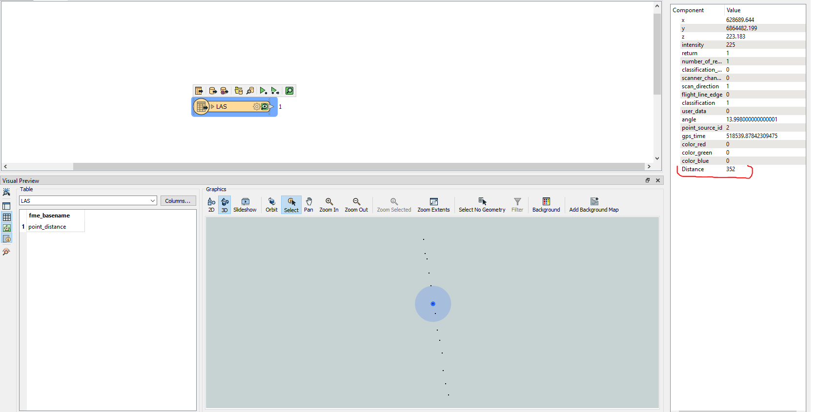
Thanks but your template is not suitable for what I want to do. I already have the distance attribute in my input file LAS (attached). I can't use PointCloudCoercer because I have about 1 billion points in my las file. I would like to use this "Distance" attribute in my FME template.
I think it is. The left bookmark is only generating the pointcloud. The right bookmark is reading a las file, then using the PointCloudStatisticsCalculator to generate the statistics. You have to manually enter "Distance" in the parameters to process it.
I think you need to add the PointCloudStatisticsCalculator downstream of the reader in your printscreen, manually add the Component "Distance" in the Statistics to Calculate and check the statistics you need.
If this is not what you need I did not understand your original question correct.