
Hi,
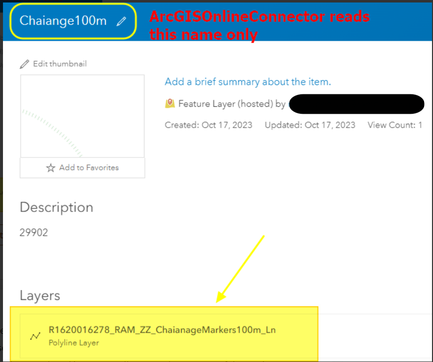
I would like to be able to read the name of the layers from AGOL that are shared with the same group. ArcGISOnlineConnector reads only the genaral name.

 +11
+11Hi,
I would like to be able to read the name of the layers from AGOL that are shared with the same group. ArcGISOnlineConnector reads only the genaral name.
Best answer by nielsgerrits
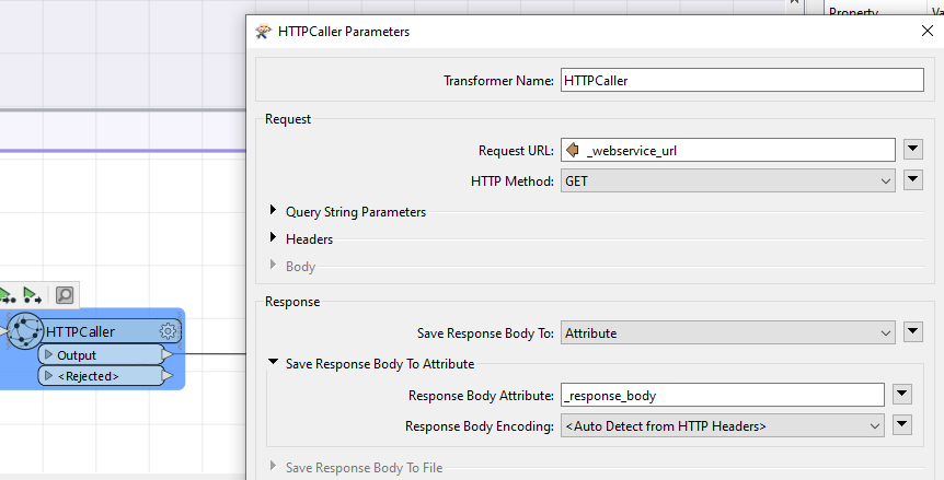
I am really sorry but it does not work. There is sth wrong with HTTP Caller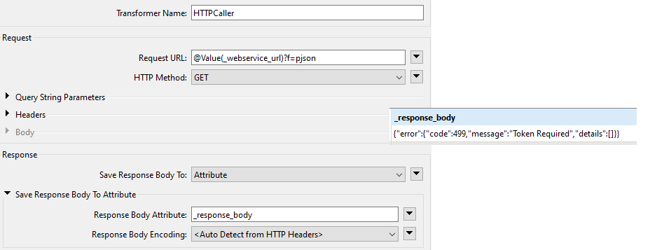
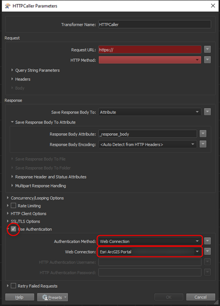
The error indicates that the service requires authentication. You need to configure the HTTPCaller to use a web connection. You can use the same web connection as you use on the ArcGISOnlineConnector.
No account yet? Create an account
Enter your E-mail address. We'll send you an e-mail with instructions to reset your password.


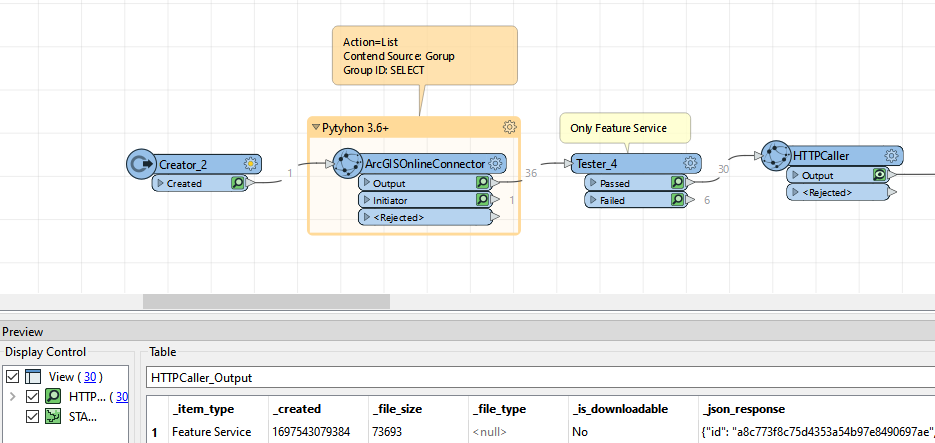 Howerver, _json_response field is missing the information about the layer name. I should have "A5WTCS2_RAM_C_Centreline_Ln_01"
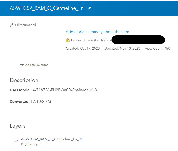
 Am I missing sth?
")

 I hope this does the trick?
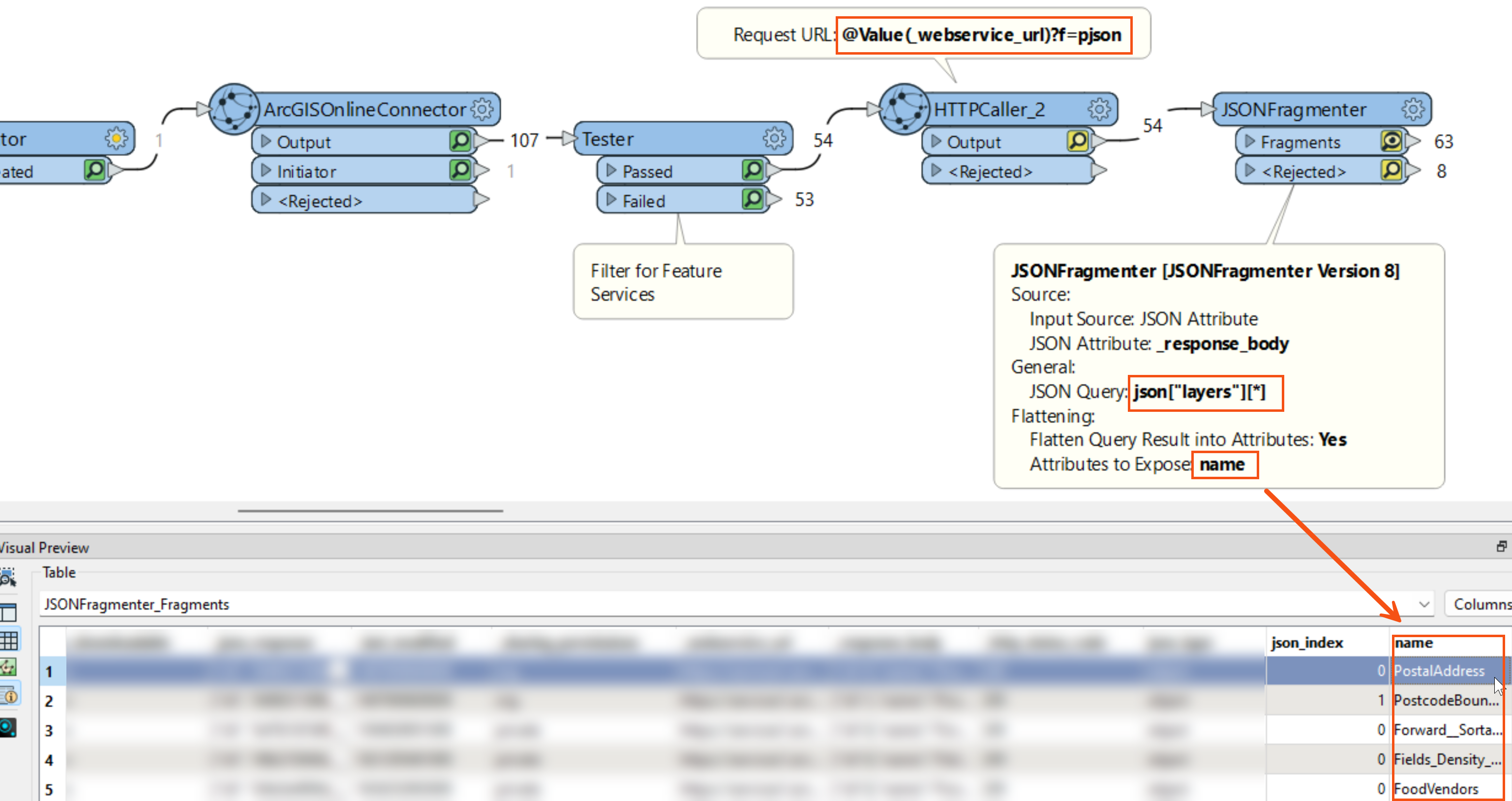 Let me know if this helps.