
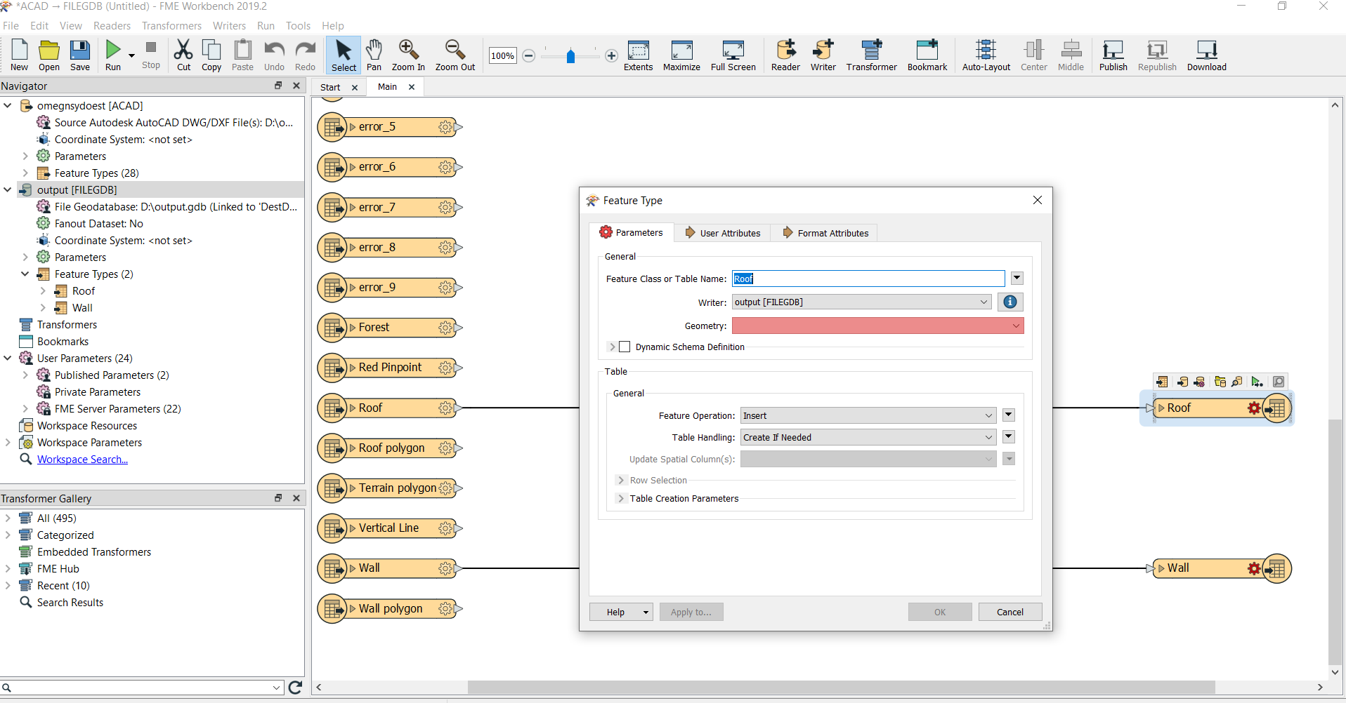
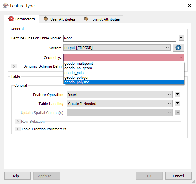
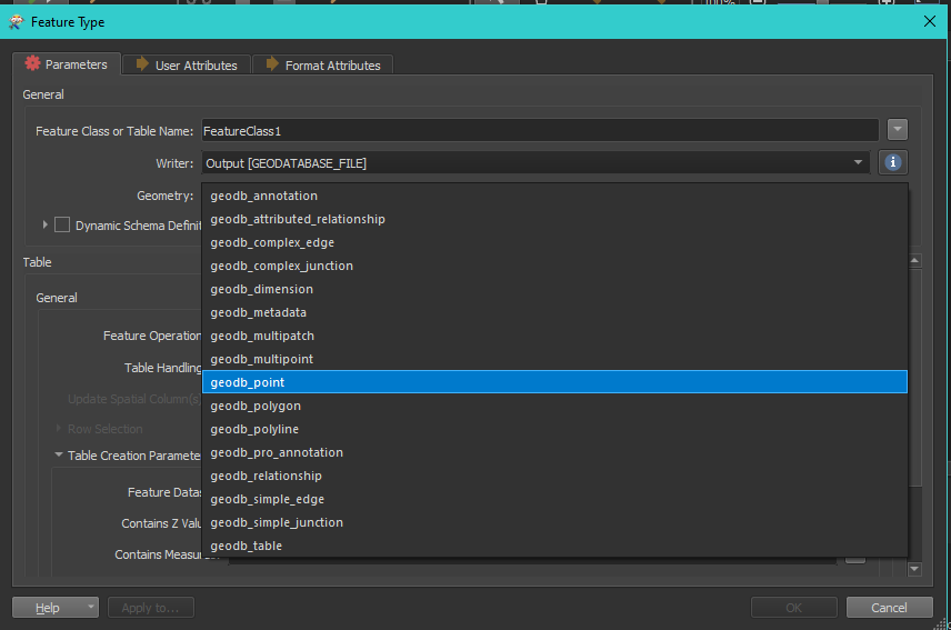
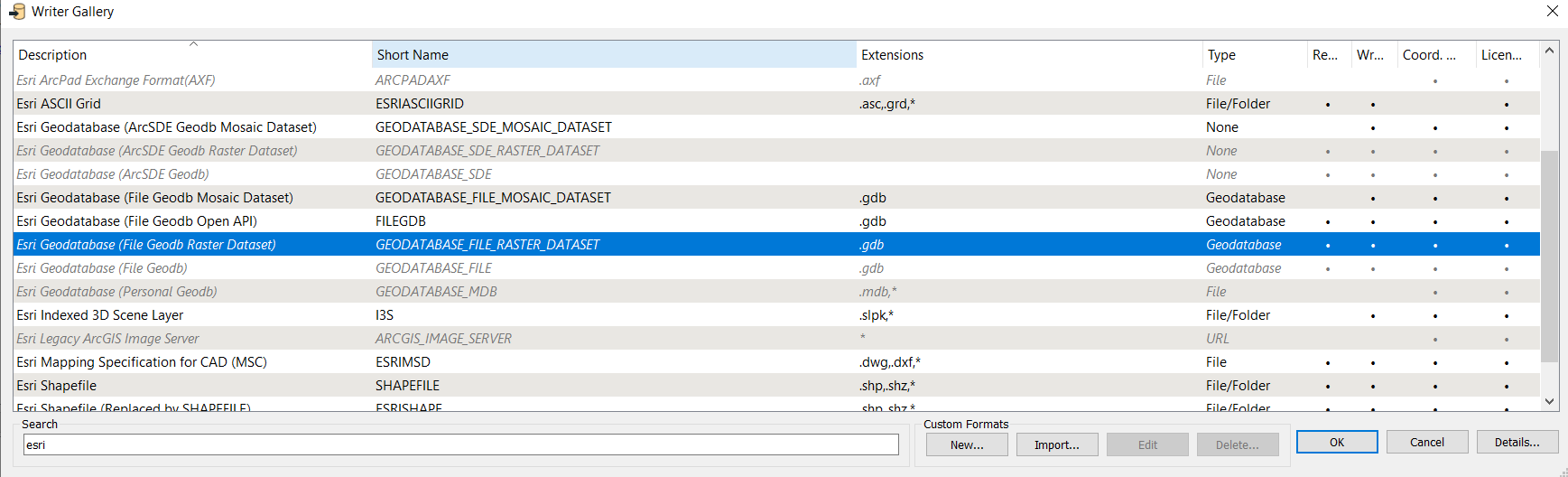
I have a DWG file with simple 3D shapes of buildings for a town, I need to convert it to Geodatabase so I can import to CityEngine. I can inspect it ok. I have tried various ways to convet it but nothing seems to work. In particular, when I attach a gdb writer there is no option to output a surface geometry (see screenshot). I also tried the auto generate workspace but that output an empty file. Any idea what im doing wrong?

Hi @eric_armitage

It appears that you are using FileGDB (which is based on Open API).


File Geodatabase(Arc Objects) writer is the correct format for this translation as it supports all the geometries for File Geodatabase.


See screenshot below, geodb_multipatch geometry type is the correct type for this workflow.

Thanks but which one is that? These are the only options I have. Do I need some kind of ESRI licence to do this?


Thanks but which one is that? These are the only options I have. Do I need some kind of ESRI licence to do this?


Yes, to use Esri Geodatabase (GEODATABASE_FILE) requires an Esri product Desktop , ArcGIS Pro, Server installed and licensed.


NOTE:

The bit version (32-bit or 64-bit) must be the same for FME and ArcGIS.

ArcGIS Desktop will let you run some processes in 64bit by installing a utility 64bit Background geoprocessing

You can download following the instructions here

  1. Log in to MyEsri https://my.esri.com/

  2. Click My Organizations --> Downloads

  3. Under Download, Select ArcGIS Desktop Version you have installed

  4. And finally, download the product and install it, here is a screen capture from Downloads page https://www.screencast.com/t/Ls8C6Ww78U8


Thanks Rahul. Not sure why they have to make it so complicated. I only have a trial CityEngine licence and its quite a basic thing I'm trying to do. Sounds like CityEngine is basically unusable unless I also have a desktop/ pro licence which probably makes it unviable.


Thanks Rahul. I'm not sure why ESRI have to make it so difficult. I only have a CityEngine trial licence and its a fairly basic thing i'm trying to do. It sounds like CityEngine is basically unusable unless you also have a desktop/pro licence. And if had Pro I could probably do the conversion with that instead of FME.


Reply