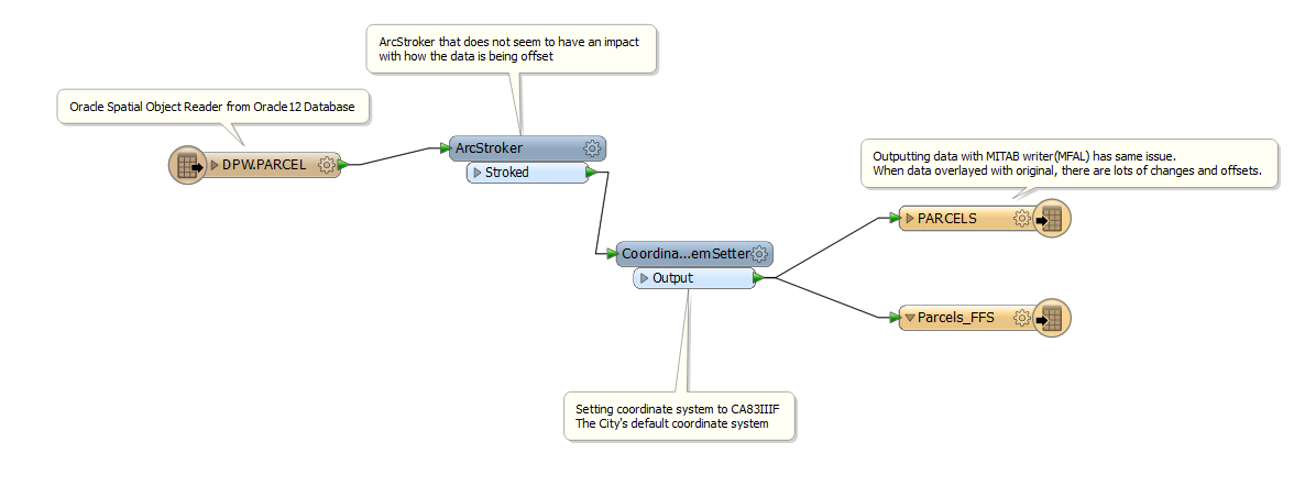
My original thought was that there was a problem with the Arcs in the data so I introduced the "ArcStroker" transformer and no matter what the settings, the data comes out looking similar. There are large gaps and slivers(>4 feet(1+ meter)) being taken away or added to many parcels.

I need the data to be accurate as it will be used to digitize other features based on property lines. I work for a large metropolitan city of more than a million people so if the data is not accurate then this could cause big issues. Anyone have an idea of what could be going on?


