Question

MAP MATCHING

  • December 9, 2025
  • 1 reply
  • 32 views

marionmahot
Contributor
Forum|alt.badge.img+4

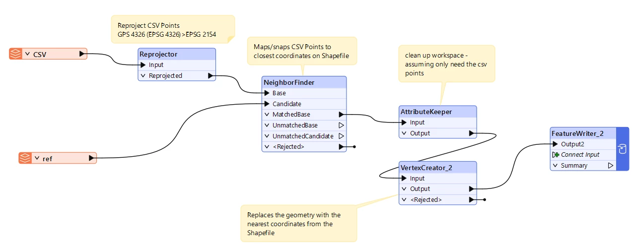
I have images taken by a camera mounted on a vehicle, with GPS (4326) coordinates recorded every millisecond. I also have a road reference dataset in a shapefile (epsg :2154) and I need to match my millisecond-spaced images (and their GPS coordinates) to this road reference. There will obviously be some discrepancies between the GPS measurements and the reference dataset, but how can I best align the GPS data with the road reference? What is the best method to do this?

If you’d like, I can also help you rephrase it more formally or technically.

Thank you

1 reply

desiree_at_safe
Safer
Forum|alt.badge.img+16

Hi ​@marionmahot! If I understand your case correctly, you should be able to do primarily using a Reprojector and NeighborFinder. I’ve shared a workspace of what I tried, hopefully it will help or at least steer you in the right direction 🙂

I think you may also be able to do this using the Snapper, but I didn’t really explore that transformer

Here’s what my workspace does:

  • Your GPS points (from CSV, in EPSG:4326) are first reprojected to match the road reference’s coordinate system (EPSG:2154) using the Reprojector.
  • The NeighborFinder transformer then finds the closest road segment (from the shapefile) for each GPS point, effectively “snapping” each image location to the road reference.
  • The AttributeKeeper keeps only the relevant attributes, including the coordinates of the closest road point.
  • The VertexCreator replaces the GPS point geometry with the snapped (matched) road coordinates, ensuring your output is spatially aligned with the road.
  • Finally, the FeatureWriter outputs the results to a CSV, so each image is matched to the nearest road location.

(created using FME 2025.1.1 but the principle should be more or less the same for other versions)