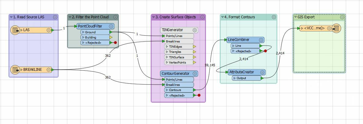
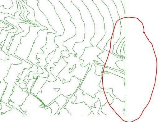
i am using a LAS dataset, which is too large to share and when using a combine line I get a boundary. I keep getting a combine line around the boundary of the area I am processing. This will have multiple contours that have different elevations, each one connects to another contour along the boundary a ways away. Thank you for your suggestions.
Hello
Could you share the workspace or FFS files to test?
Thanks,
Danilo
@vanhornsky The best way to avoid these edge effects is to grab more data than you need and then clip back to the extent you're actually interested. As a general rule, if you can extend you data an extra 10% past the area of interest, contour that, then clip back to the area of interest. This works well if you're contouring tiles as well. ensure there is about 10% overlap on the neighbouring tiles and then clip back to the tile boundary.
How do I build the boundary? I have the general square tile areas, but I would like to build the area of interest.
@vanhornsky If you have the tile boundary, you can use the Bufferer or GeographicBuffer to expand the tile boundary by some amount. If you don't have the tile boundary, you can use the BoundingBoxAccumulator to get the extents of your dataset and then buffer that