


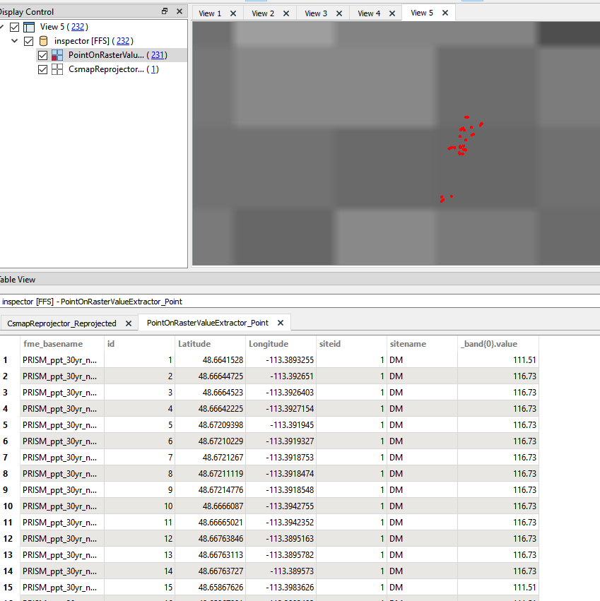
It seems straightforward enough using the PointOnRasterValueExtractor. The problem is it is only grabbing one value and putting that in all the points. I am guessing that the secondary files with the tiff may hold that 'value,' but I am unsure. The last screenshot shows the data doing it the slow way through ESRI's geoprocessing tools. Any help would be appreciated.

Question
I have image files that I need to run through and extract the pixel values at my point layer's locations. It is not working out as planned...


Login to the community
No account yet? Create an account
An FME Account is required to contribute
LoginEnter your E-mail address. We'll send you an e-mail with instructions to reset your password.