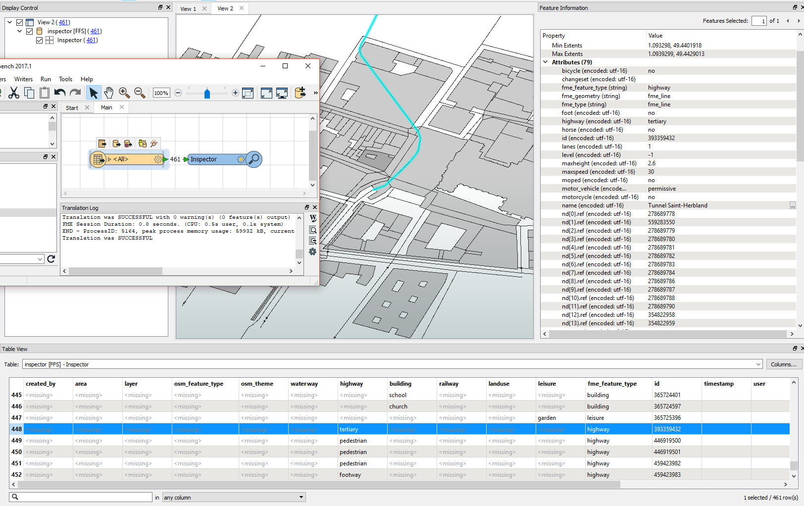
Hello,
I am trying to work with data from OpenStreetMap, and I have an issue with retrieving tags.
The only tags I get are the ones related to 1st level types. Other attributes appear in the inspector right panel, but I cannot access it from in my workflow. So what is the difference between attributes from the Table View and the Feature Information ? Is there any way to access those specific features information from the Workbench ?
Strangely enough, when I check the "Determine feature by scanning the entire dataset", all tags also appears in the Inspector Table View (with a lot of missing values). But I cannot use that option from my main workflow, as my dataset is an URL (returning an OSM XML file).

So far, I am only looking for a few attibutes on a few elements, like the "layer" value for highways (which indicates if they are underground and above or below other highways).
Any help would be much appreciated, as this is very important for my work :)


