Question

ESRI Raster Mosaic Dataset to LAS creates unusual striped and incomplete output

  • August 31, 2025
  • 2 replies
  • 45 views

mgg_beca
Supporter
Forum|alt.badge.img+16

Hi there,

I have created a Mosaic Dataset in ArcGIS Pro from downloaded 1m DSM GeoTIFFs. This displays fine in ArcGIS Pro.  The boundary of the mosaic is clipped to the extent of the data I want to analyze.  

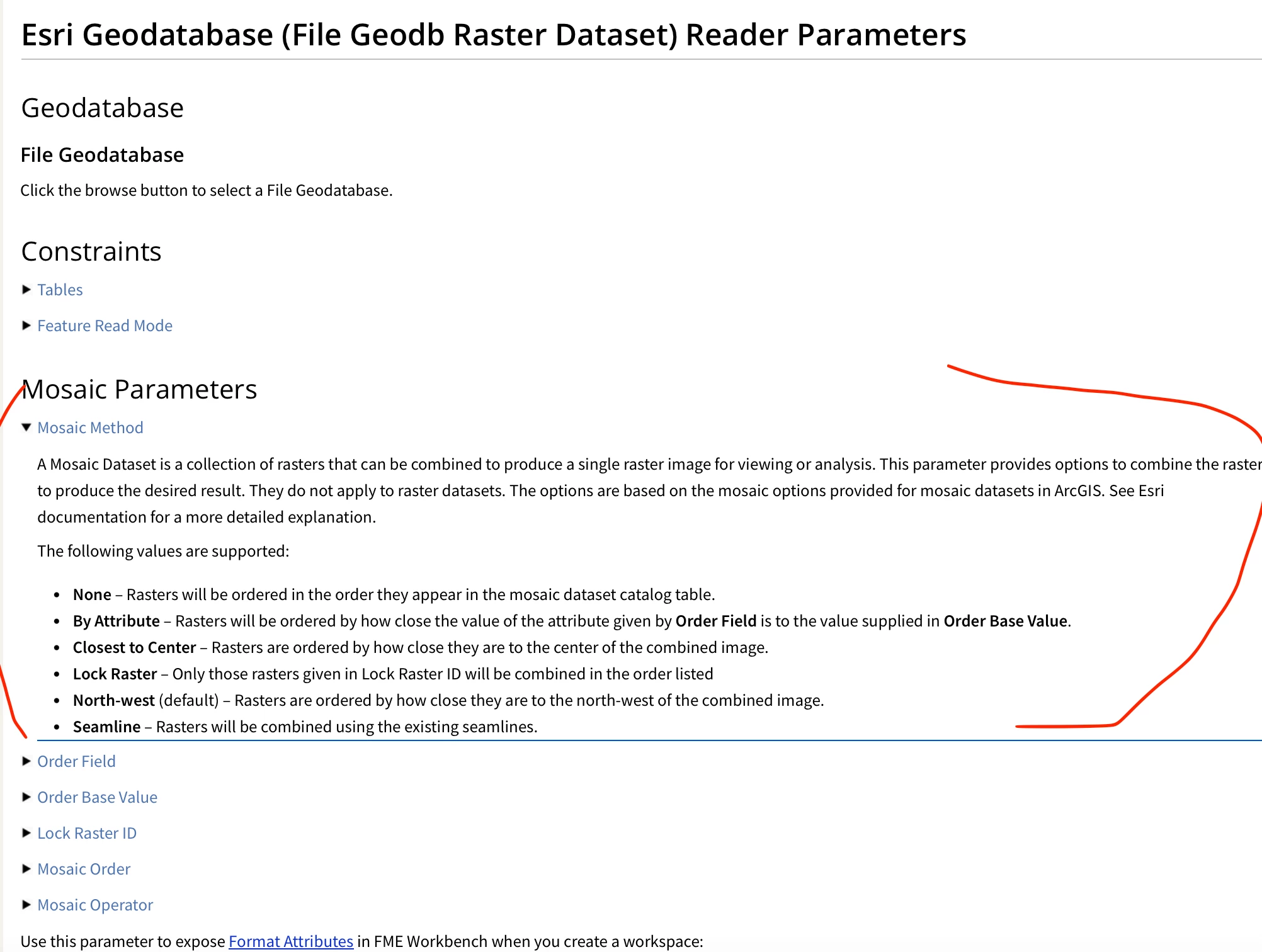
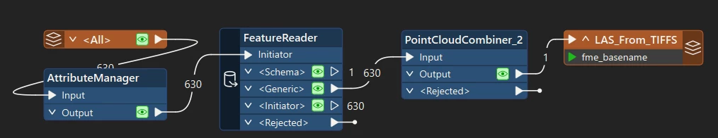
I need to convert this to LAS to run some ArcGIS GP tools. So I have done this using the Mosaic Dataset as an input in FME:

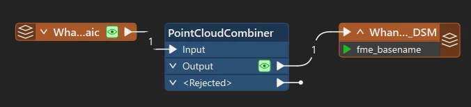
Esri Geodatabase Raster  → Point Cloud Combiner → LAS Writer

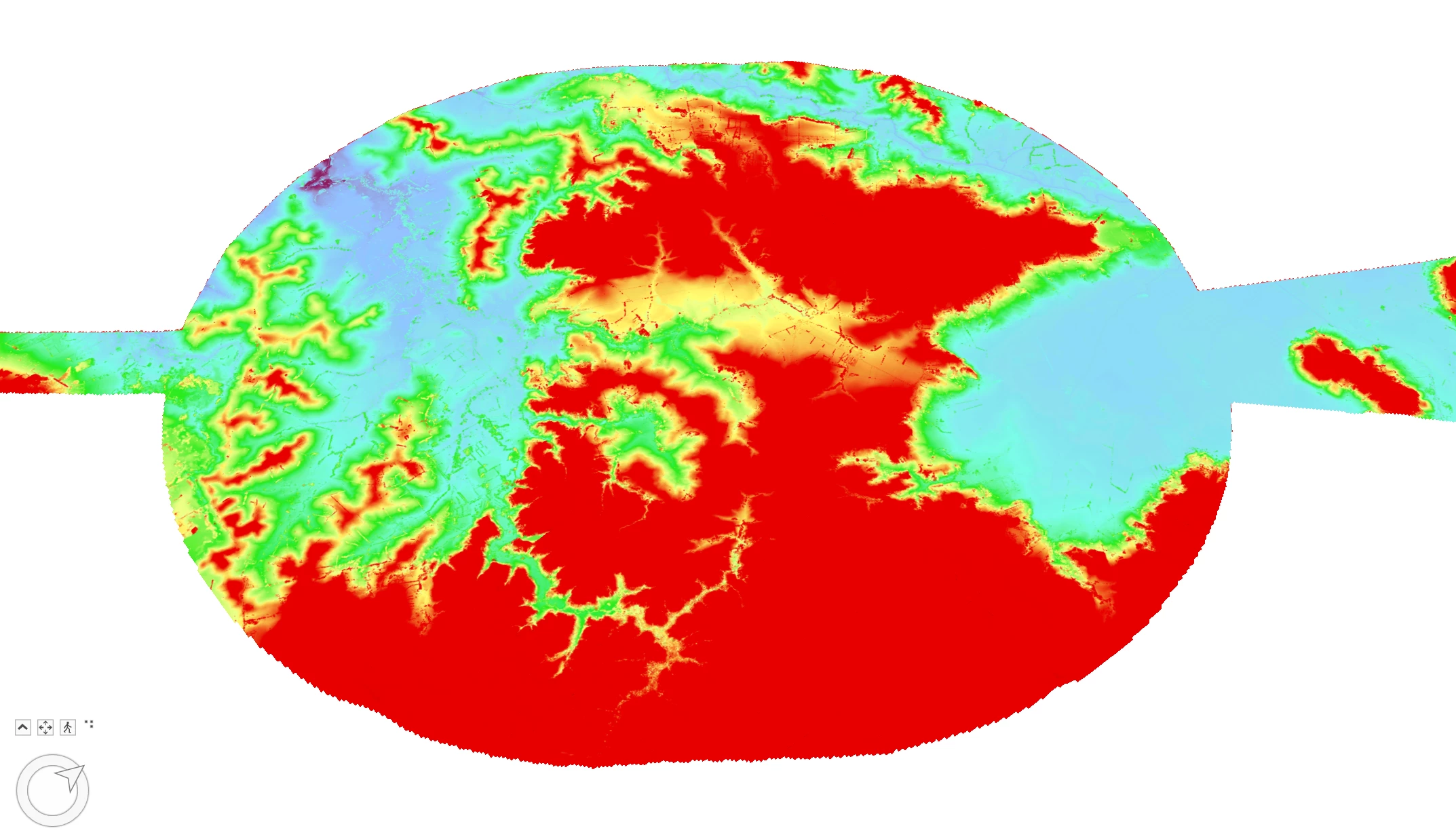
The output shows some incorrect data striping and looks like it missed some areas. In ArcGIS Pro:
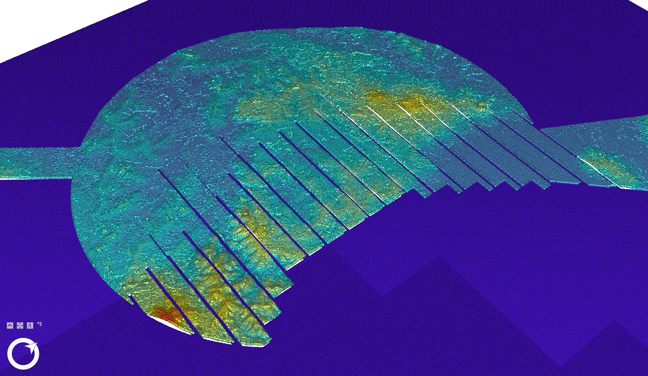
In FME Inspector:

I don’t see any out of memory errors or issues with reading the Mosaic data in the FME logs.

Any ideas?

Thanks,

Marc

2 replies

j.botterill
Influencer
Forum|alt.badge.img+53
  • Influencer
  • September 1, 2025

Have you checked the parameters on the Reader, assuming its a fGDB source https://docs.safe.com/fme/html/FME-Form-Documentation/FME-ReadersWriters/geodatabase/GEODATABASE_FILE_RASTER_DATASET_reader.htm

there's sheetings in the parameter for method… order...etc

Then also read up in detail about https://docs.safe.com/fme/html/FME-Form-Documentation/FME-Transformers/Transformers/pointcloudcombiner.htm

Rasters are converted as follows:

  • The x and y components are created from the cell ground coordinates, or columns and rows if the raster has no coordinate system.
  • The first selected numeric band will become the z component.
  • The first selected bands with red/green/blue/gray interpretations will become the color_red/color_green/color_blue components.
  • Additional selected bands will also be preserved. If the band has a name, the component name will be the band name. If the band has no name, the component name will be bandN, where N is the band index.
  • Nodata may optionally be extracted

mgg_beca
Supporter
Forum|alt.badge.img+16
  • Author
  • Supporter
  • September 1, 2025

Thanks for your response.

I have left everything in the mosaic dataset reader as default, also the pointCloudCombiner.  As far as I can tell, this should read all the rasters in the mosaic and convert them to a point cloud.  There is nothing complicated about the tiffs, they are simply single band DSMs.  There is no overlapping data, so the mosaic parameters should not matter. 

For reference, I read in the tiffs natively using a csv exported from the mosaic footprints and a  featureReader, and converted these to LAS and the output is perfect.