

when I view the drawing in map3d the cs is listed. When i view the dwg with arccatalog i can see the same CS. however when i add it to workbench it is not being recognized.
I am trying to set up a dynamic workbench to re project coordinates dependent upon the cs of the reader being used. Is there a way to get the autocad cs and set that to a published parameter?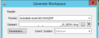


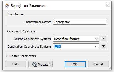 Not sure if this helps, but it is likely more relevant than what i posted last night. (I am still a rookie at FME) The Reprojector will read the CS of the source, so you can leave it as unknown at the reader stage.

