I have created a prototype workspace to create a 3D minecraft world by combining the 2D surface feature data from an orienteering map and a Lidar point cloud for the topography.
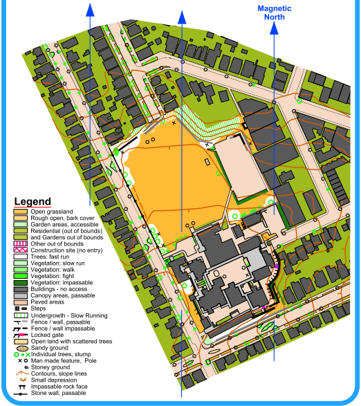
Here is what the source map looks like 
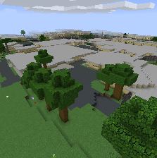
And here is the resultant minecraft world -
This workspace generated a Minecraft map of our local intermediate school which I have just created an orienteering map for. I have tried the workspace out on other urban orienteering maps (including one with lakes and tramways) and it worked pretty well, but it probably needs a bit more work for forest Orienteering maps.
There is still work to do on this template. I would welcome comments and contributions on how to improve it. All features are not yet modelled. More clipping needs to be done for overlapping features. Z data needs to be built into railways. But I'd call it a good start (from a GIS beginner), and it potentially opens up a world of "virtual orienteering"!
I have uploaded an example template here --> https://hub.safe.com/templates/ponsint-las2minecraft5
