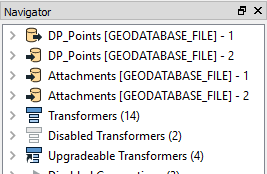
Hi, I'm struggling with processing Geodatabase Attachments. My workflow takes polygon features with attachments, test for an attribute and then converts them to points. Pretty simple. However, keeping the attachments isn't working. I know there are other help examples using attachments but I'm not able to get this to work. My workflow and sample data is attached. If someone could please take a look and let me know what I'm missing?
This post is closed to further activity.
It may be an old question, an answered question, an implemented idea, or a notification-only post.
Please check post dates before relying on any information in a question or answer.
For follow-up or related questions, please post a new question or idea.
If there is a genuine update to be made, please contact us and request that the post is reopened.


