
Hi All,

I’m new to process LiDAR data using FME and just received a bunch of LAS files that need to process as DEM (output). 

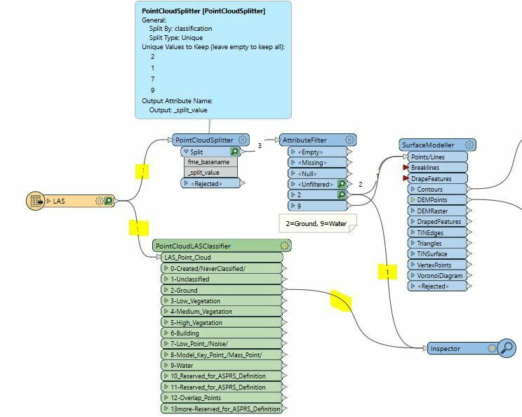
I was doing some reading and users sue the _classifciation to classify the data but have just realised that my data isn’t classify as my classification filed is 0? Screenshot below:


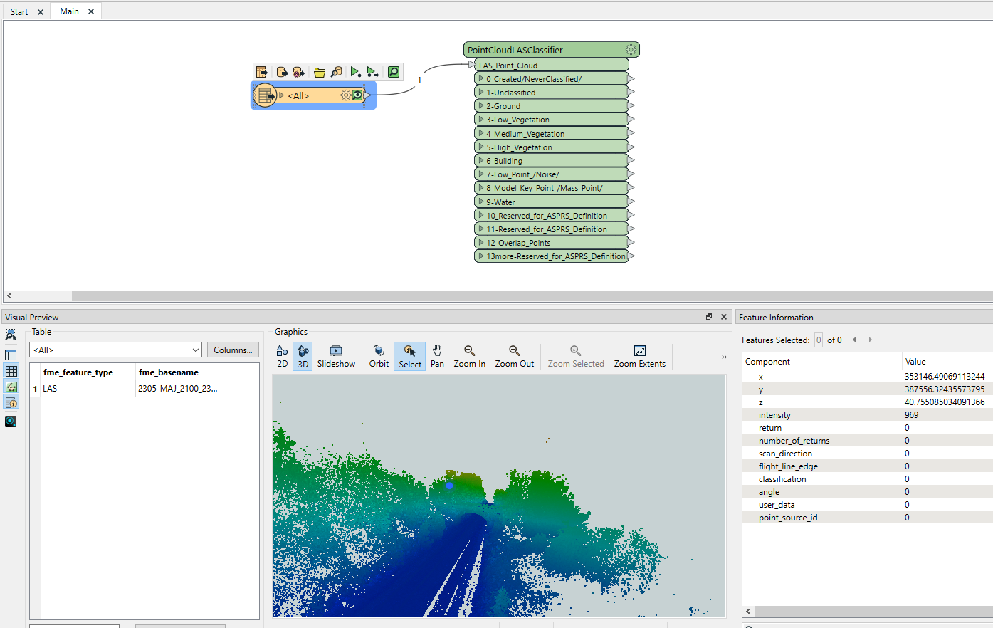
I’ve also tried to use the PointCloudLASClassifier but the classification is 0 so doesn’t work. 

Any trick to classify the data and be able to export the DEM?

Hi All - I have been doing some investigation ans seems the classification for the non-classified LAS data can be possible by using https://rapidlasso.de/ tool but need license for it,

Is there any workaround or tool to classify LiDAR data (within FME or outsite FME)?

Thanks


Hello @galigis,

1.) Generate Points from your LAS Files with PointCloudToPointCoercer

Info: befor that, maybe you will reduce the number of points (PointCloudThinner)

2.) In your screenshot: i can see that the highlighted Point have the Value Z=40…. thats good.

2.1) The Output of the PointCloudToPointCoercer, should you send through a Tester.. but befor this you need to generade the Attribute Z/high of the Points you generated, with the CoordinateExtractor.

3.) Set a Tester with a Range from Z(0) Value to 1,. maybe thats enought  ? (i dont know the Z values of allpoints from ur screenshot) and you can send this points to the DEMGenerator.


Hope i can help,

greetings Michael


Do all points in your point cloud have Classification=0? 

You could also try another approach than the PointCloudLASClassifier - for some LAS files it doesn’t seem to catch the classification properly. See my screendump below; if I pass the data through a PointCloudSplitter and an AttributeFilter, the “Ground” Classification (2) turns out, but not when passed through the PointCloudLASClassifier. 


Reply