
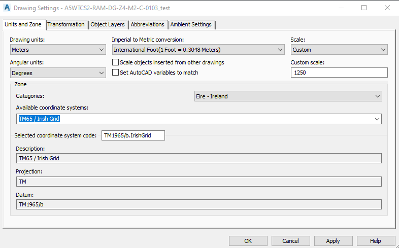
Hi, I have a Civil 3D CAD model and need to extract information from the Drawing Settings.
However, the available data comes from the Drawing Units window instead
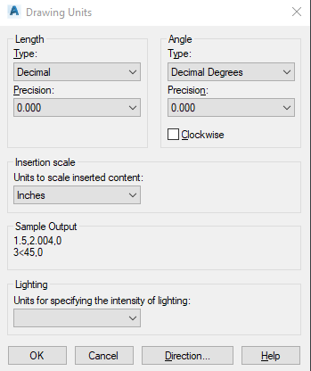
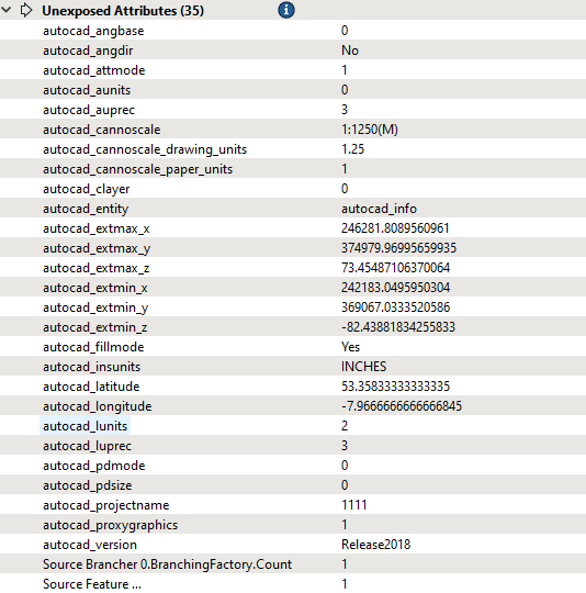
, which can be very different from what’s in the Drawing Settings

 +11
+11Hi, I have a Civil 3D CAD model and need to extract information from the Drawing Settings.
However, the available data comes from the Drawing Units window instead
, which can be very different from what’s in the Drawing Settings
No account yet? Create an account
Enter your E-mail address. We'll send you an e-mail with instructions to reset your password.
")
