I have two KMZ files containing states and cities borders. I want to combine them and find out which city falls under which state as a result in some tabular format. How I can achieve this with FME? Are there any transformers available for this?

Solved
Can I combine two KMZ files and extract the result of combined kmz's in a csv file or a table with FME?
Best answer by chrisatsafe
Hi @gauripearl,
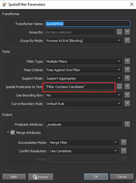
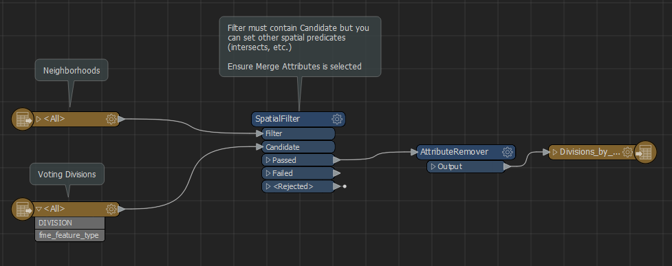
The SpatialFilter is likely the transformer you are looking for. The SpatialFilter will allow you to determine which states contain which cities using a spatial predicate (i.e. Filter contains Candidate). Check out the Determining Spatial Relationships article to learn more!
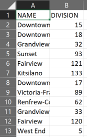
Once you have determined the spatial relationships, you can use something like the AttributeRemover or AttributeManager to remove, rename, and re-order the attributes before sending the features to a CSV Writer.
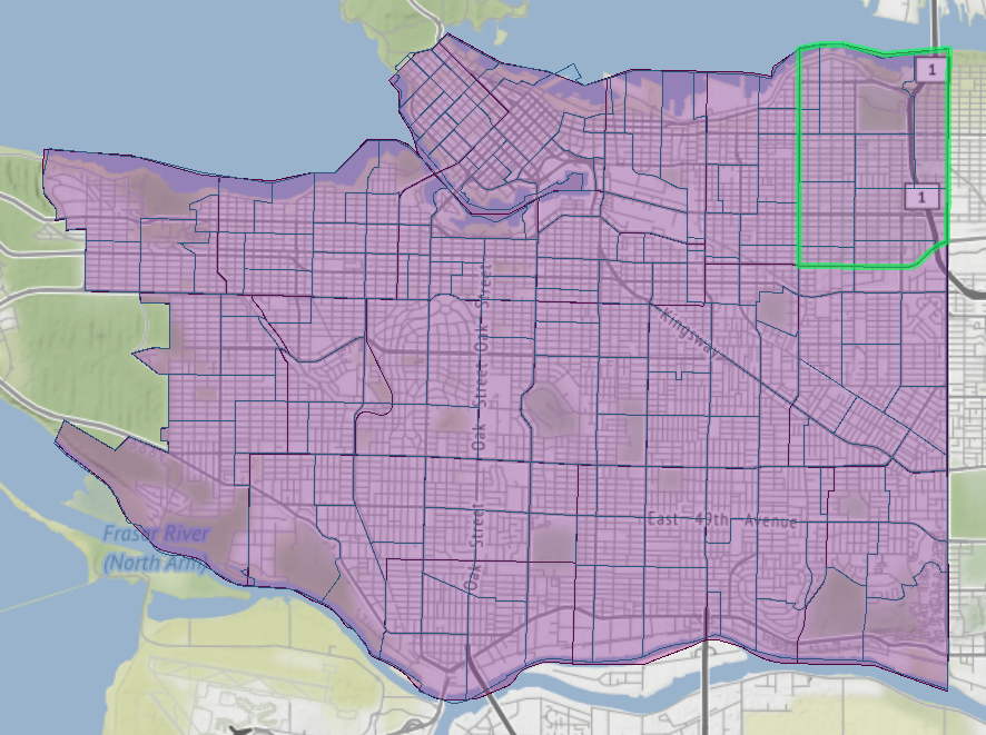
I have attached an example which demonstrates a similar task - determining which voting boundaries belong to each neighborhood using data from the Vancouver Open Data Catalogue.
Hope this helps!
Input(s)
Output
Divisions_by_Neighborhood.fmw
This post is closed to further activity.
It may be an old question, an answered question, an implemented idea, or a notification-only post.
Please check post dates before relying on any information in a question or answer.
For follow-up or related questions, please post a new question or idea.
If there is a genuine update to be made, please contact us and request that the post is reopened.


Login to the community
No account yet? Create an account
An FME Account is required to contribute
LoginEnter your E-mail address. We'll send you an e-mail with instructions to reset your password.