Dear All,
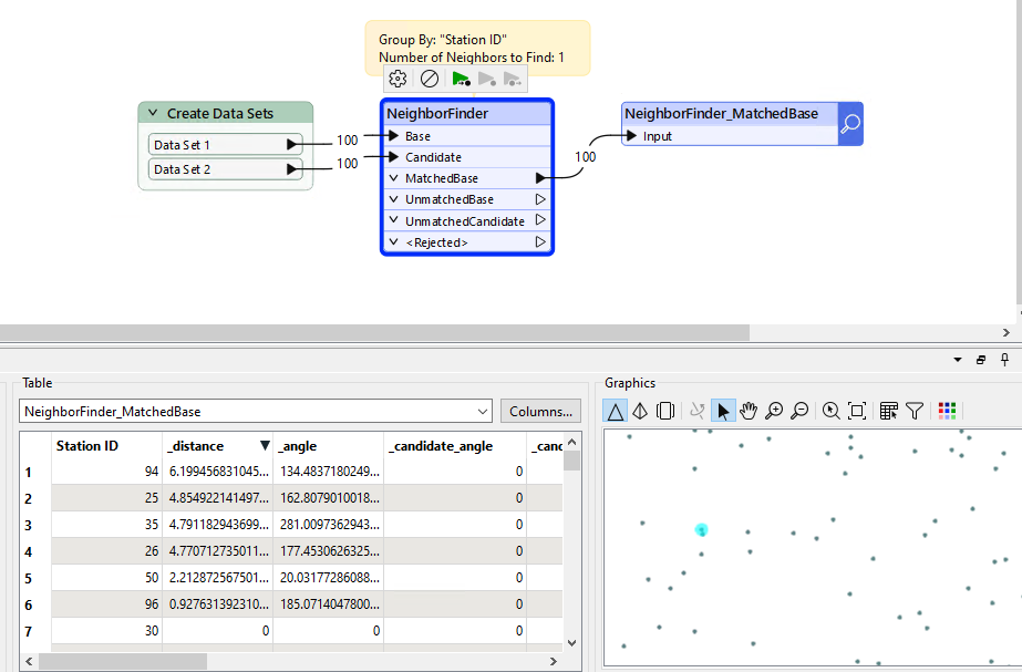
I’m working with two datasets that share a common key: Station ID. Each dataset provides coordinates ( latitude and longitude) for these stations. My objective is to determine whether the station with the same ID have identical location in both datasets or if there are discrepancies.
To achieve this, I need to calculate distance between the corresponding coordinates from both datasets. While this seems straightforward, but I encountering challenges in implementing it effectively. I would appreciate any help on the best approach.
Thank you in advance.
BR//