Hi all,
I have a CSV file containing stops with fields stop_lon and stop_lat. I’m trying to turn them into geometry and reproject them so I can use them with other layers.
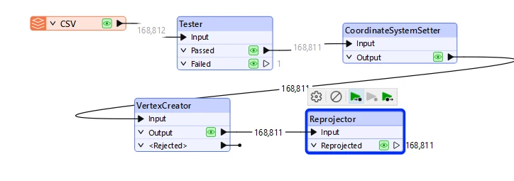
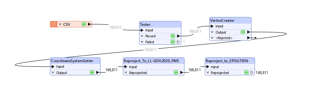
My workflow looks like this:
CSV → Tester → VertexCreator → CoordinateSystemSetter → Reprojector -
In VertexCreator I assign
X = stop_lon,Y = stop_lat. -
In CoordinateSystemSetter I set the source coordinate system to
EPSG:4326. -
In Reprojector I reproject to
EPSG:7856(GDA2020 / MGA Zone 56).
After running this, the points don’t land in the right place compared to my suburb polygon layer (which is already in EPSG:7856). In QGIS, both layers line up fine (on-the-fly reprojection), but in FME they don’t.
Clearly I’m missing something in how I’m handling coordinate systems — but I can’t see where the mistake is.