Hello everyone,
I have produced a dataset in oracle. I can't display those data in ArcMap because of the issue "the number of points is less than required for feature".
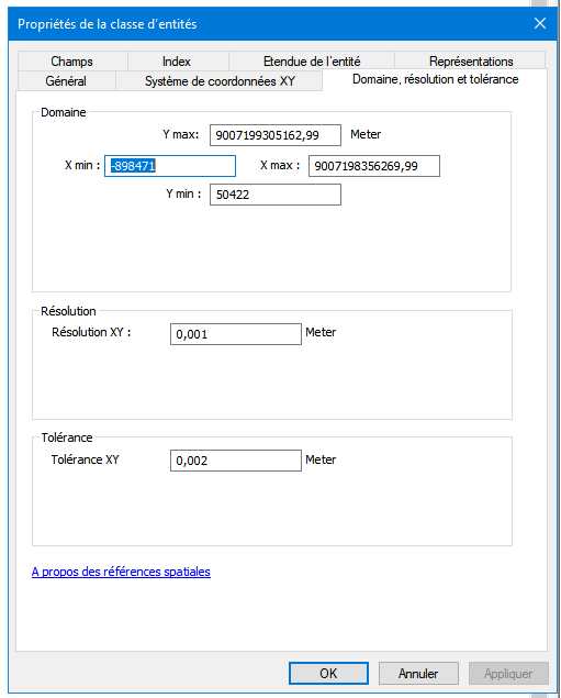
After reading several posts, I now understand that the issue come from the esri grid (toleand and precision) which snap point and this snapping process when displaying data in esri create some geometric issues like self-intersections that were not in oracle.
I thought of writing to a temporary geodatase. However, after importing the feature from the geodabase to oracle, I still face the same issue.
Because, it is an esri issue, the geometry validator is not able to detect them. However, there used to be a transformer called ArcSDEGridSnapper which is now deprecated.
How could I replicated the ARcGRidSnapper function in my workbench in order to identify and exclude (or repair) the features that will cause geometric issues in ESRI?


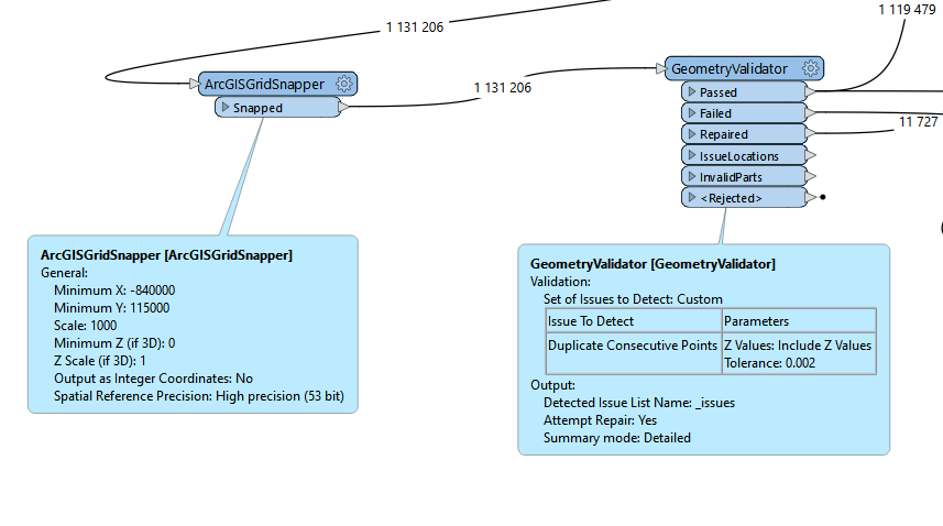
 This is the configuration that I used in the ArcGISGridSnapper followed by a geometryValidator and after the ArcGISGridSnapper, I added a GeometryValidator
 But it didn't work. What did I miss?