")

Hi All,
I am trying to reproject some .e57 files containing LiDAR scans and oriented imagery collected with a terrestrial scanner. Reprojecting the point cloud is straightforward, but I am having some trouble with the imagery.
I can see in the Feature Information window that the image locations seems to be stored in the e57_translation_x, y, and z Geometry Traits (Geometry->Raster->Geometry Traits), here’s a screenshot from Data Inspector:
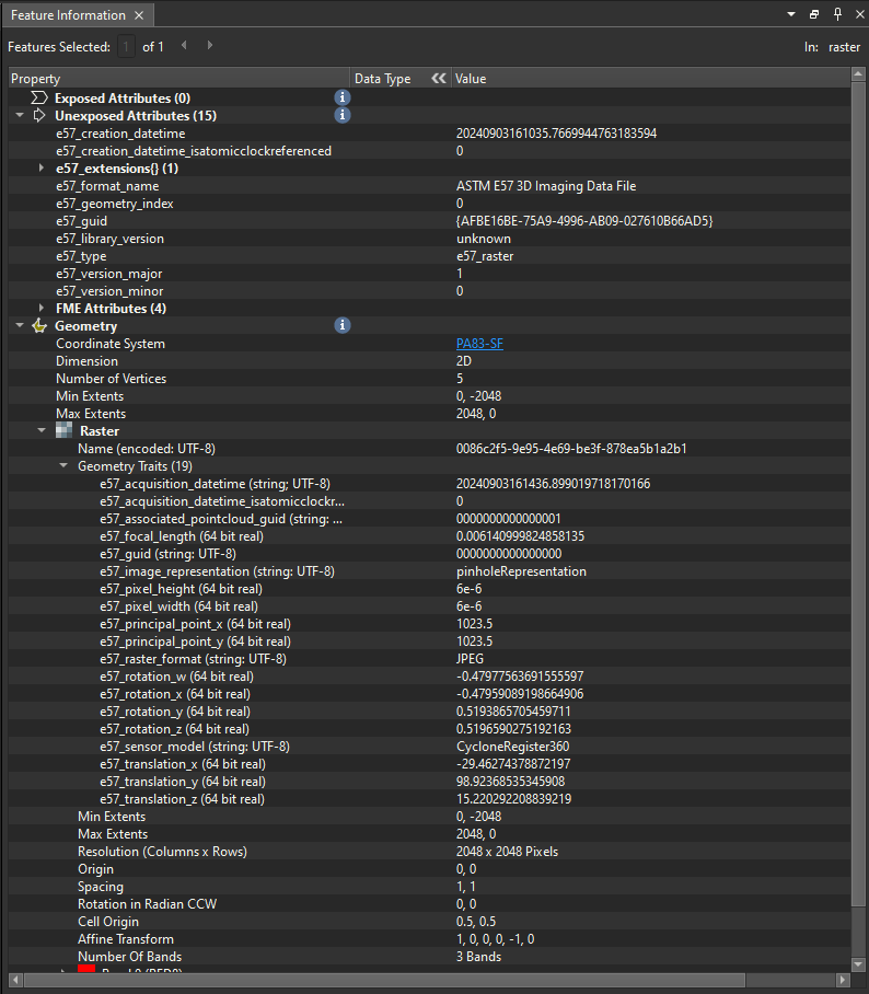
I’m working from a local coordinate system, hence the low translation values.
My goal (I think) is to extract these translation values, reproject them in the same way I’m reprojecting the point cloud, and then write the new values back in to these traits, but I’m not sure how to access these trait values, and was wondering if anyone had experience with this.
Thanks for looking!


")