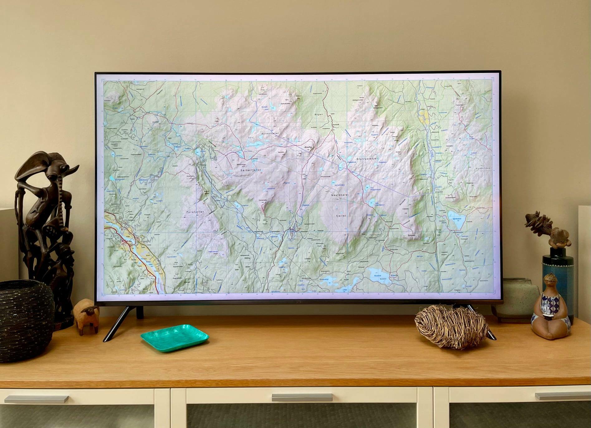
Hi, I am new using FME for cartography and I am not sure how can I create those elements in a raster map (north, graticule of coordinates, scale bar), I am currently using Mapnik rasterizer transformer to represent my raster and vector layers, and some labels, but I can't see how can I go from that to a complete map with all its elements. Thanks in advance!

Solved
How to create a graticule, north arrow and scale bar in a cartographic representation
 +2
+2Best answer by chrisatsafe
There are some transformers available that can help you with this but might not be as refined as the tools gazza mentioned. For example, one user has uploaded the ScaleBar transformer on the FME Hub. Personally I haven't used it myself so I'm not very familiar with it but you might be able to make use of that.
With regards to graticule lines, perhaps you could use a 2DGridAccumulator and a pair of LineBuilders (group by set to row in one, column in the other)? You could also extract the coordinates and create labels for the axis of your choosing. In the attached workspace, I have it placing labels on the bottom and right axis. From there, you could offset the labels, etc., etc.
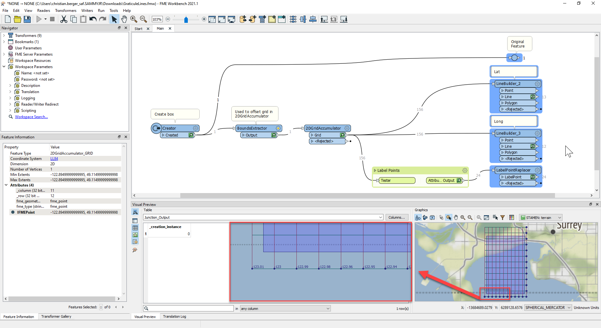 Haven't tried the north arrow but hopefully that gives you a couple of ideas!
This post is closed to further activity.
It may be an old question, an answered question, an implemented idea, or a notification-only post.
Please check post dates before relying on any information in a question or answer.
For follow-up or related questions, please post a new question or idea.
If there is a genuine update to be made, please contact us and request that the post is reopened.


Login to the community
No account yet? Create an account
An FME Account is required to contribute
LoginEnter your E-mail address. We'll send you an e-mail with instructions to reset your password.