

Hello Forum,
I have two polygon datasets read into a FME Form workspace:
Dataset 1: Super Output Area (SOAs): This is where the entire authority area is divided into 165 SOAs. No part of our authority area is not covered by a SOA.
Dataset 2: Air Quality Focus Areas (AQFAs): These are specific areas for a particular purpose. Only selected parts of the authority area are covered by an AQFA.
Datasets 1 and 2 are entirely different and do not share boundaries or nest etc. If that happens anywhere it is entirely coincidental.
I need to know what percentage of each SOA intersects (overlaps) with an AQFA area. Some SOAs are going to be fully outside an AQFA. Some SOAs will be partially within an AQFA. Some SOAs will be fully within an AQFA.
I want to know what percentage of each SOAs is within an AQFA. The results would be added as a new attribute to the SOA dataset as a percentage value (0-100).
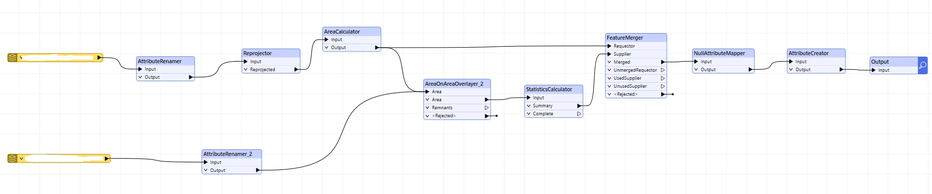
I know that using AreaOnAreaOverlayer I can chop up the SOAs where they intersect with AQFAs. But I want to keep the SOAs intact but with a percentage value of the SOA that may fall within an AQFA.
Thanks