I am taking a polygon that is the floor of a building, I am then clipping out the exterior wall and the room polygons on it to get the square footage of the space between the walls. However, it is filling in polygons at random when writing to our SDE. When I write these polygons to a .gdb, that behavior doesn’t happen. I have tried to not simplify the geometry, used the donut extractor to only take the outershells, orientor to only choose right facing polygons, etc. Anything else I should try?
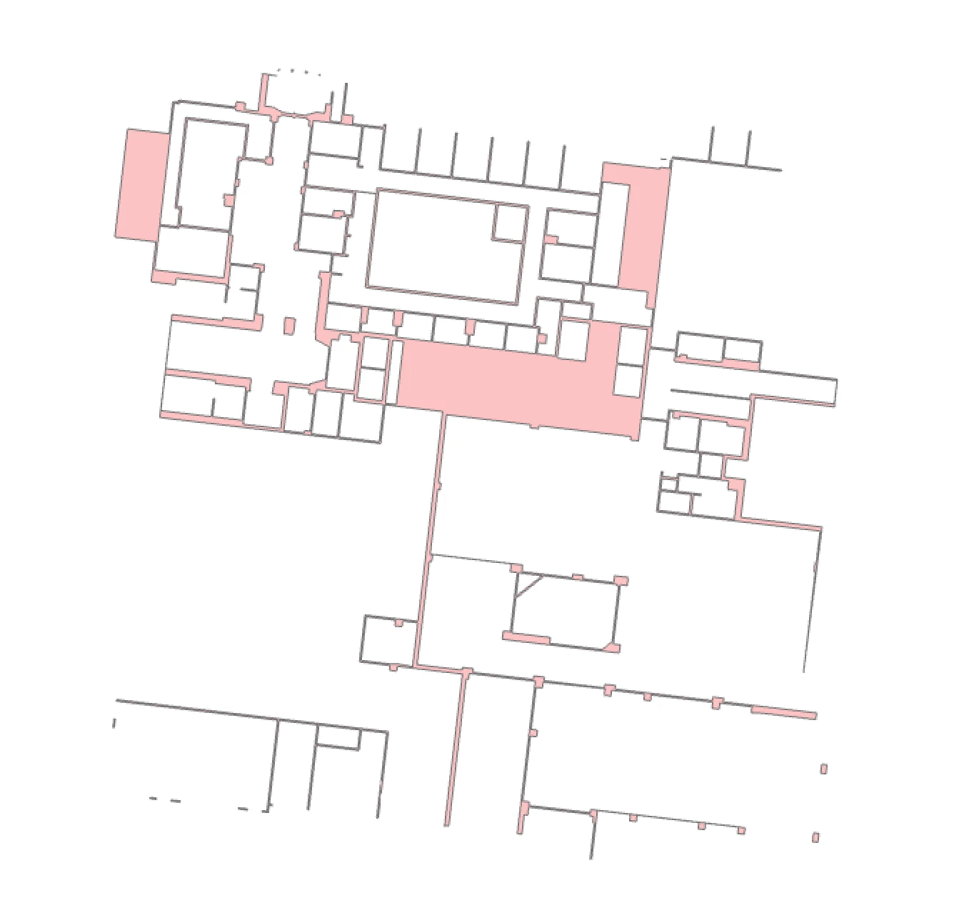
Preview of the polygon in FME:
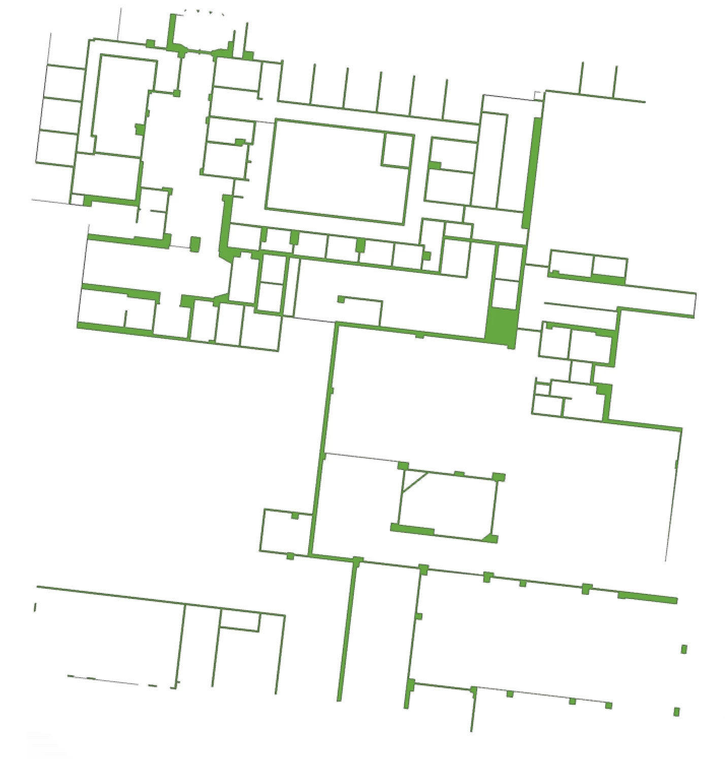
Polygon in GDB:
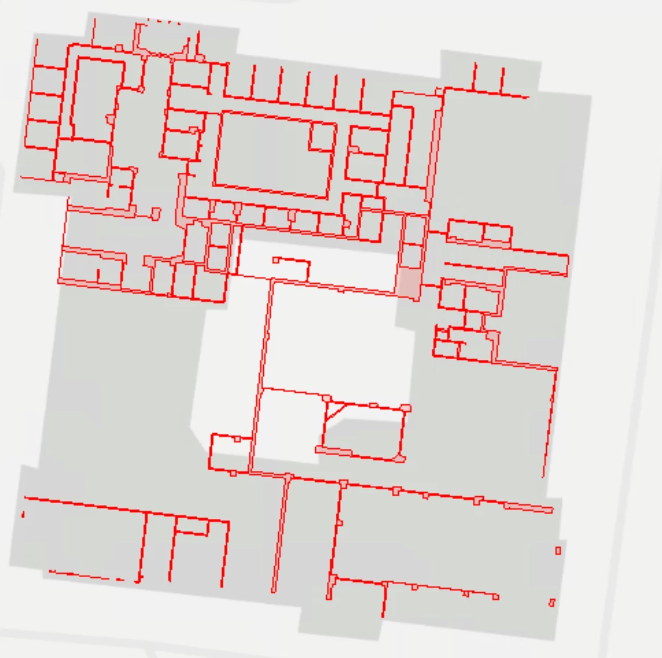
Polygon in SDE: