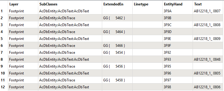
I have a polygon shapefile with imagery footprints but with image name blank ('Text') and a point shapefile that has an image name ('Text'). There is no common attribute to link them together but if I use the NaturalSorter transformer on the EntityHand attribute then there is logic how they are linked together. Records 1 and 2 are linked, as are 3 and 4 etc. How do I then group records 1-2, 3-4, 5-6, 7-8 and so on together to conflate the two datasets?