Question

Error: “the number of points is less than required for feature”,


jamal
Forum|alt.badge.img+5
Error: “the number of points is less than required for feature”,


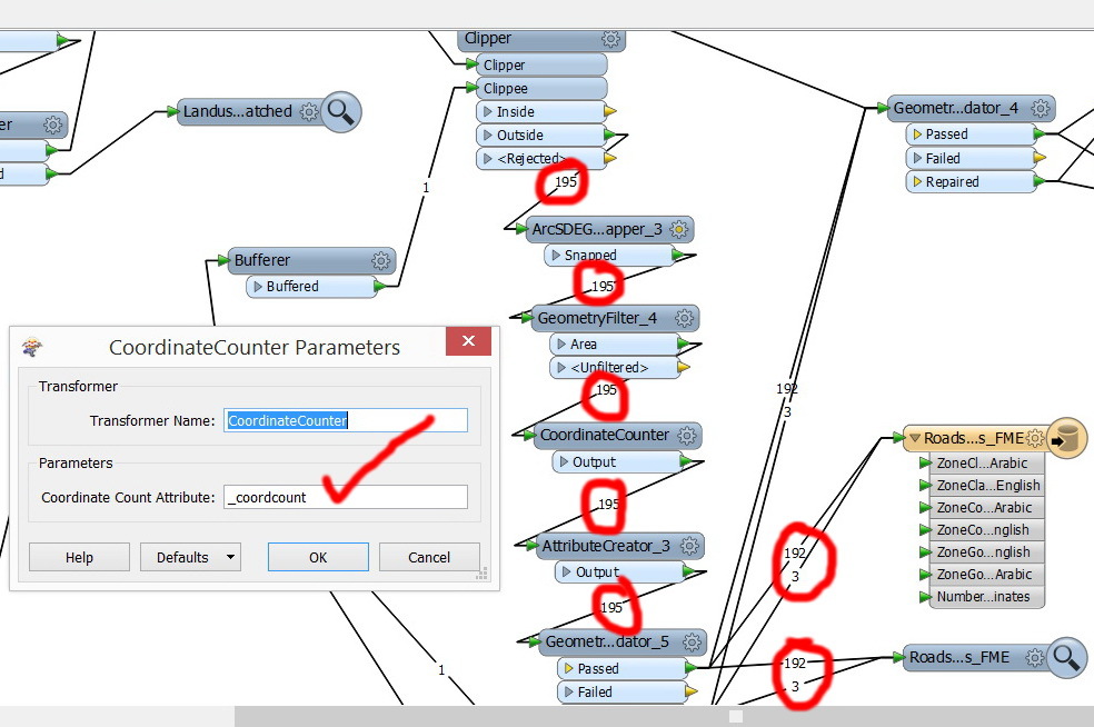
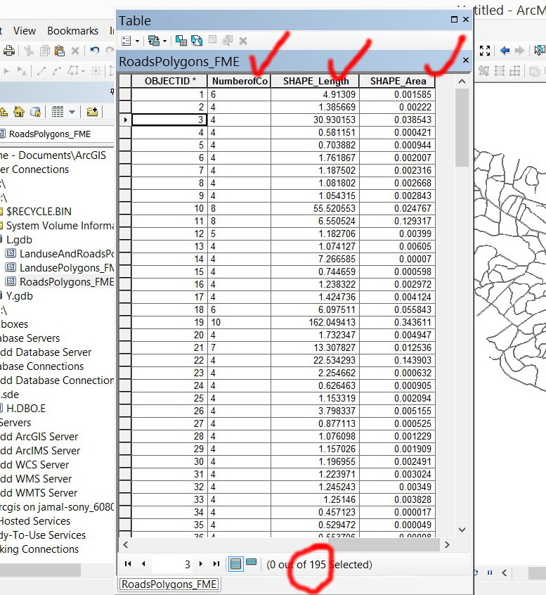
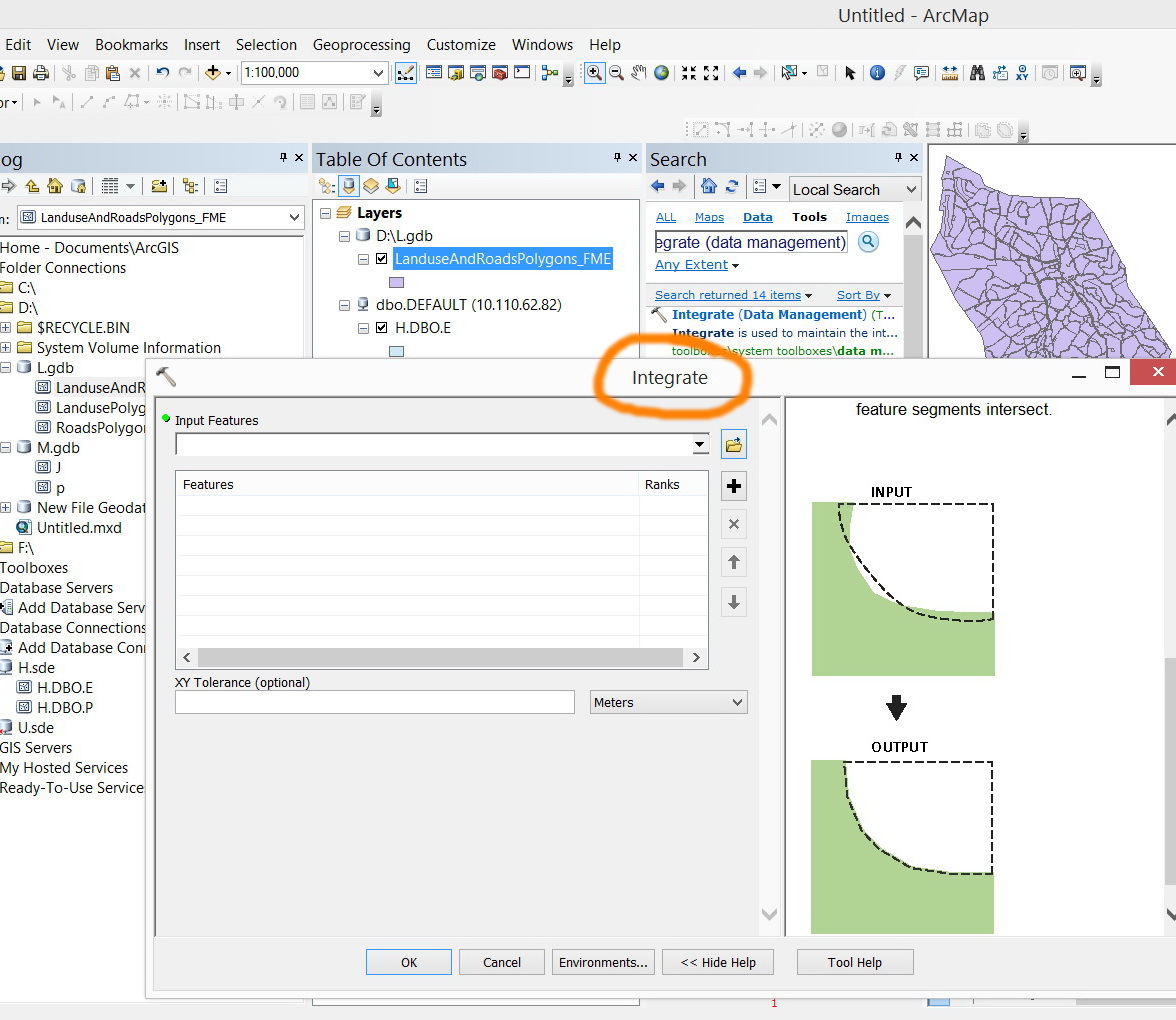
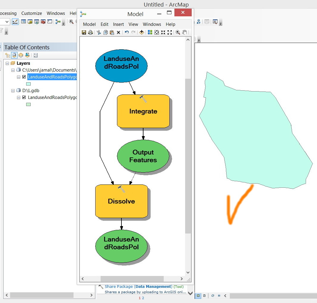
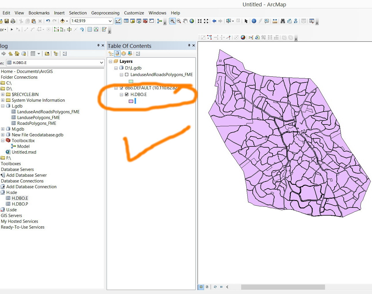
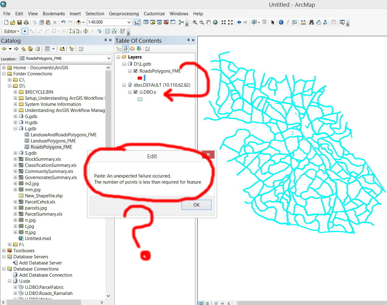
We are extracting data from CAD files. The destination is layers stored in ESRI file Geodatabase. Copying the features from the generated layers to other enterprise geodatabse layers result in the error below:
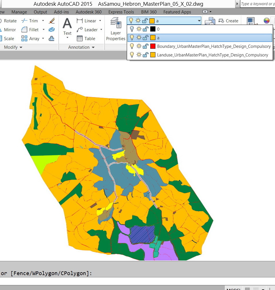


CAD file:


http://www.mediafire.com/download/ii2dszjoo4zoij4/AsSamou_Hebron_MasterPlan_05_X_03.dwg


Workbench


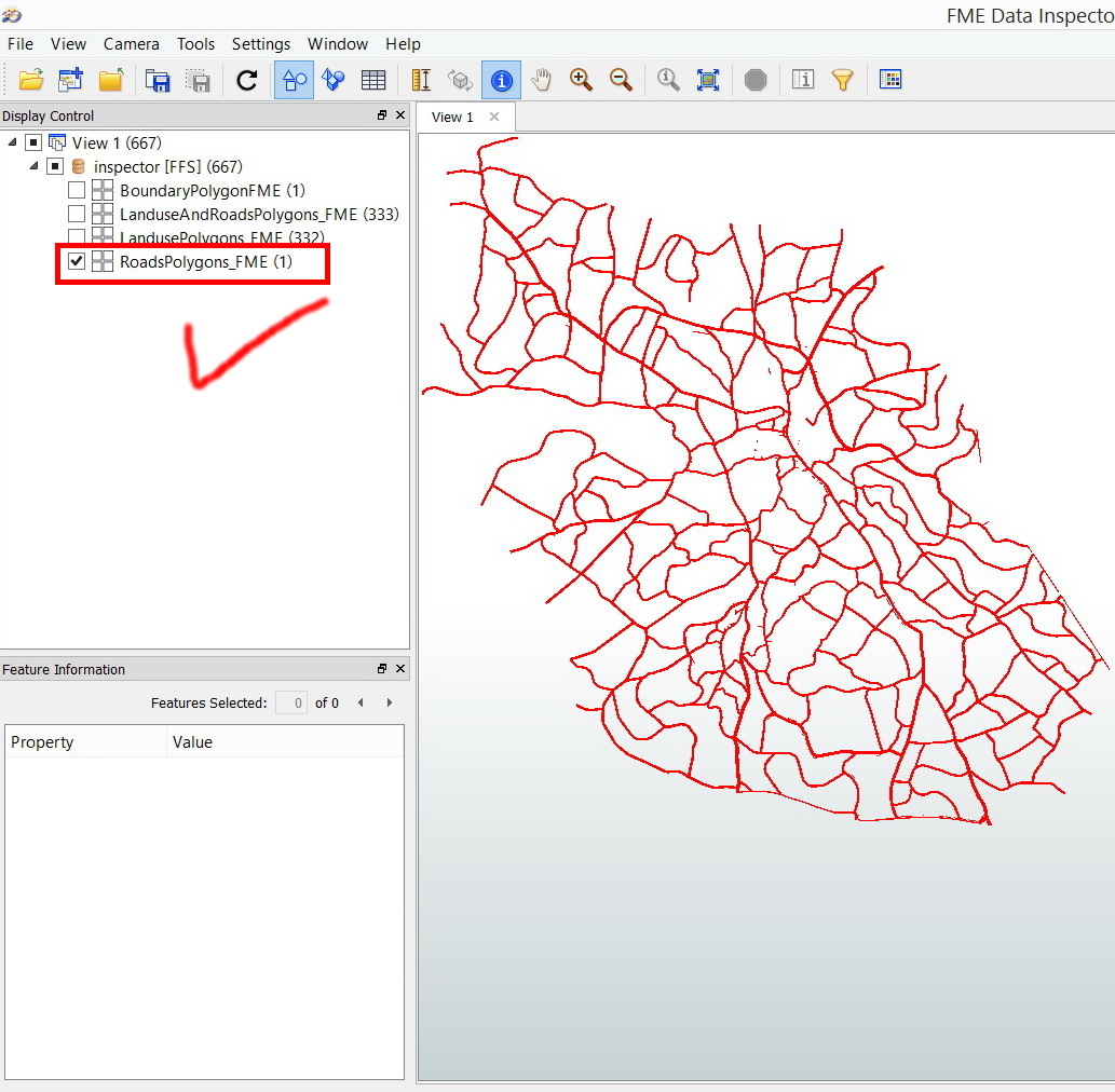
Extracting the Roads polygon (Roads = Boundary – Landuses)


What might be the issue here?


Thank you


Best


Jamal

12 replies

jamal
Forum|alt.badge.img+5
  • Author
  • April 23, 2014

david_r
Celebrity
  • April 23, 2014
Hi,


sounds like an invalid geometry. Set an inspection point just before the output feature type (circled in red) and inspect the number of coordinates of the first feature that goes through.


You could also insert a CoordinateCounter with a Tester to check for e.g. polygons with < 3 vertices or lines with < 2 vertices.


Also make sure that the coordinates aren't so close to one another that they're getting conflated into a single point by ArcSDE (distance < tolerance).


David

takashi
Influencer
  • April 23, 2014
Hi Jamal,


Just guessing. The road geometry looks an aggregate of a large donut polygon and several fragment polygons. Some of fragments perhaps have less than 4 vertices.


Try specify "No" to Create Aggregates parameter of the Clipper and remove unnecessary fragments before writing.


Takashi

jamal
Forum|alt.badge.img+5
  • Author
  • April 23, 2014
Many thanks guys for the help,


Neither the “CoordinateCounter” nor the “create aggregates :No” has resolved the issue.


Applying the “check geometry” in the ArcGIS shows the features that have problems despite the fact all of them have area, length and number of vertices more than two.


This way I’m back to the first circle: the FME has no sufficient tools to repair the Geometry to be accepted by the enterprise geodatabase layer.


I’m wondering why I should face all of these problem just to extract the roads layer from the boundary and landuse


Roads = Boundary – Landuse


If the Boundary and Landuse are valid then how come the result (Roads) is not valid?

takashi
Influencer
  • April 24, 2014
What about removing unnecessary small fragments before writing?

jamal
Forum|alt.badge.img+5
  • Author
  • April 24, 2014
Thanks Takashi.


Deleting small polygons will definitely cause a problem as donuts\\holes\\gaps are generated within the LanduseAndRoads layer. In this case, if the Boundary is re-derived from this layer (LanduseAndRoads), gaps will be created inside this layer (this might occur at the level of ArcGIS for further analysis).


I got help from GIS expert at enterprise level. He advised to apply the “integrate” tool in the ArcGIS to resolve the issue of self-intersecting. It works as a charm till now. The power of the “integrates” is that it repairs the polygons without deleting them (and thus it doesn’t leave gaps).


What might be the equivalent tool for the “integrate” (of the ArcGIS) in the FME?


takashi
Influencer
  • April 24, 2014
I think the SliverRemover transformer is close to "Integrate" tool of ArcGIS.

jamal
Forum|alt.badge.img+5
  • Author
  • April 24, 2014
Thanks Takashi.


Now, I’ll try to go for your previous valuable suggestion. To remove the slivers (small areas). Gaps\\holes\\donuts can be refilled again with correct geometry by the “Eliminate Polygon Part” tools available in the ArcGIS.


Do we have such tool (“Eliminate Polygon Part”) in the FME?

samisnunu
Contributor
Forum|alt.badge.img+10
  • Contributor
  • April 24, 2014


Hi Jamal,


A corresponding transformer to the geoprocessing tool "Eliminate Polygon Part", is to use the DonutHoleExtractor


Sami

jamal
Forum|alt.badge.img+5
  • Author
  • April 28, 2014
Thanks Sami.


best


Jamal

gisbradokla
Enthusiast
Forum|alt.badge.img+16
  • Enthusiast
  • April 2, 2024

USE SQL to change the tolerance


UPDATE schemaname.tablename
    SET geom = ST_RemoveRepeatedPoints(ST_SnapToGrid(geom, 0.001));


gisbradokla
Enthusiast
Forum|alt.badge.img+16
  • Enthusiast
  • November 12, 2024

I think what i have determined is that the initial read is coming from a planar CS. then i transform that to GCS. which in turn makes some of the smaller lines (because of the grid size in the GCS) merge coordinates to the same values and causes a 2 point pline to become a single point. I would like to be able to figure out what it would take to work around this problem and not have to snaptogrid in the stgeom. I have wondered if increasing the precision of the coordinates prior to transformation to GCS would allow these small lines to maintain all coordinates.


Cookie policy

We use cookies to enhance and personalize your experience. If you accept you agree to our full cookie policy. Learn more about our cookies.

 
Cookie settings