
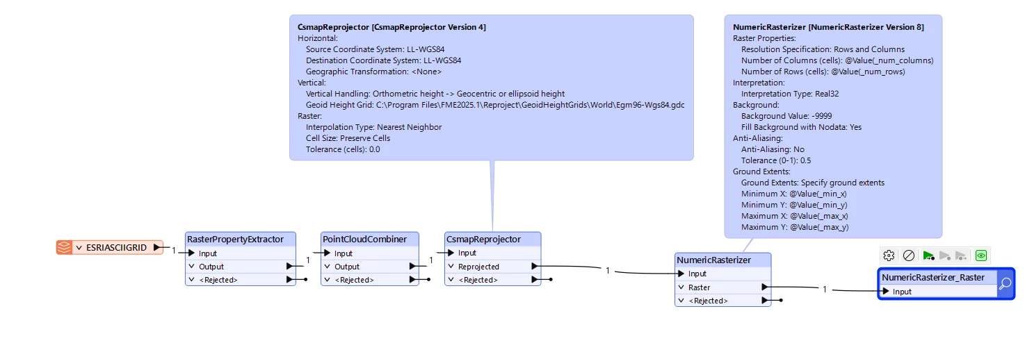
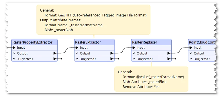
I have an orthometric DEM that I need to convert to WGS84 Ellipsoid.   I know the CSMAP reprojector treats all raster data as 2D.

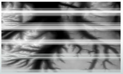
I tried converting the raster to a point cloud, reprojecting it and then re-rasterizing, but I am getting a weird striping effect I don’t know how to deal with.


Hi ​@jdh ,

I was able to reproduce a similar issue, it's really weird.

In my quick test, the issue occurred only if the source raster format was ESRIASCIIGRID, didn't occur on other raster formats e.g. GEOTIF. I therefore guess that there could be an internal falt in the ESRIASCIIGRID reader. I would recommend you to submit a new support ticket about the issue to Safe support.

I found a workaround in the interim. Try changing the internal raster data structure from ESRIASCIIGRID to GEOTIFF before PointCloudCombiner, using a pair of RatserExtractor and RasterReplacer, as in: