Solved

Using Spatial Filter within a FeatureReader


bec
Contributor
Forum|alt.badge.img+5
  • Contributor

I’m using FME Workbench 2023.1.  I have a workspace where I am trying to use a FeatureReader with a Spatial Filter for a constraint to limit the number of Parcels I bring in from the Parcels layer by running them spatially against the Corporate Boundary layer.  I’m new to FeatureReaders and I’m not sure what I am missing to get this to work as intended.  I have my Corporate Boundary layer connected to the Initiator Port on the FeatureReader.  The settings for the FeatureReader point to the ESRI REST Service URL of the Parcels layer.  And no matter what Spatial Filter selection I use: Initiator OGC - Contains Result, Initiator OGC - Intersects Result, Initiator OGC - Within Result...I only get 1 output to the Schema and 1 output to the Initiator port.  See the image below.  Can someone please explain what I might be doing wrong or missing when trying to use the FeatureReader?
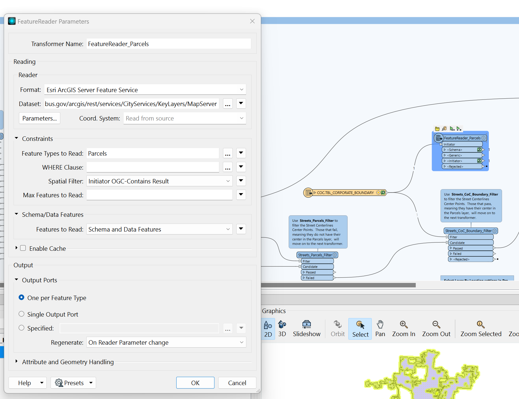
 

FeatureReader_Parcels Parameters view with FME Workspace in the background.


Best answer by nielsgerrits

Do you get any features when no spatial filter is defined? Just to be sure the service returns features.

Does the input feature has the same coordinate system as the features in the service? If not, you can use the reprojector to correct this.

View original
Did this help you find an answer to your question?

3 replies

nielsgerrits
VIP
Forum|alt.badge.img+53
  • Best Answer
  • March 28, 2025

Do you get any features when no spatial filter is defined? Just to be sure the service returns features.

Does the input feature has the same coordinate system as the features in the service? If not, you can use the reprojector to correct this.


bec
Contributor
Forum|alt.badge.img+5
  • Author
  • Contributor
  • March 31, 2025

@nielsgerrits It was definitely the coordinate system that was the issue.  The CoC Boundary layer didn’t match the coordinate system of the parcels.  I just changed my source for the CoC Boundary layer to a source that I knew would match the coordinate system of the Parcels layer and now the FeatureReader is working as expected with the Spatial Filter applied. Thanks for pointing that out as one of the possible issues.  It’s very easy to overlook!


nielsgerrits
VIP
Forum|alt.badge.img+53
bec wrote:

@nielsgerrits It was definitely the coordinate system that was the issue.  The CoC Boundary layer didn’t match the coordinate system of the parcels.  I just changed my source for the CoC Boundary layer to a source that I knew would match the coordinate system of the Parcels layer and now the FeatureReader is working as expected with the Spatial Filter applied. Thanks for pointing that out as one of the possible issues.  It’s very easy to overlook!

Cheers!


Reply


Cookie policy

We use cookies to enhance and personalize your experience. If you accept you agree to our full cookie policy. Learn more about our cookies.

 
Cookie settings