I'm using the PDFStyler to create an interactive geospatial PDF where users can click on a point to launch a photo in a separate viewer. I've managed to get this to work, but would like to customise the PDF slightly.
The main issue is how can I get the points to be a larger? At the moment they are very small and I can't see an obvious parameter to change. Buffering the point first doesn't help.
Also, any pointers on how I can insert things like a title into the PDF and make it appear above the map?
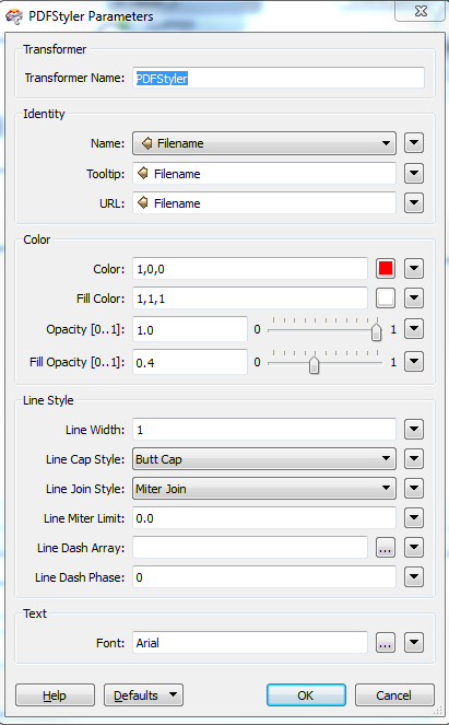
Here's my parameters:

Here's my PDF:
http://db.tt/7DVGGRjc
Any help would be much appreciated!
Amit


