Question

Help to Offset coordinates from excel using vertex

  • October 6, 2014
  • 4 replies
  • 44 views


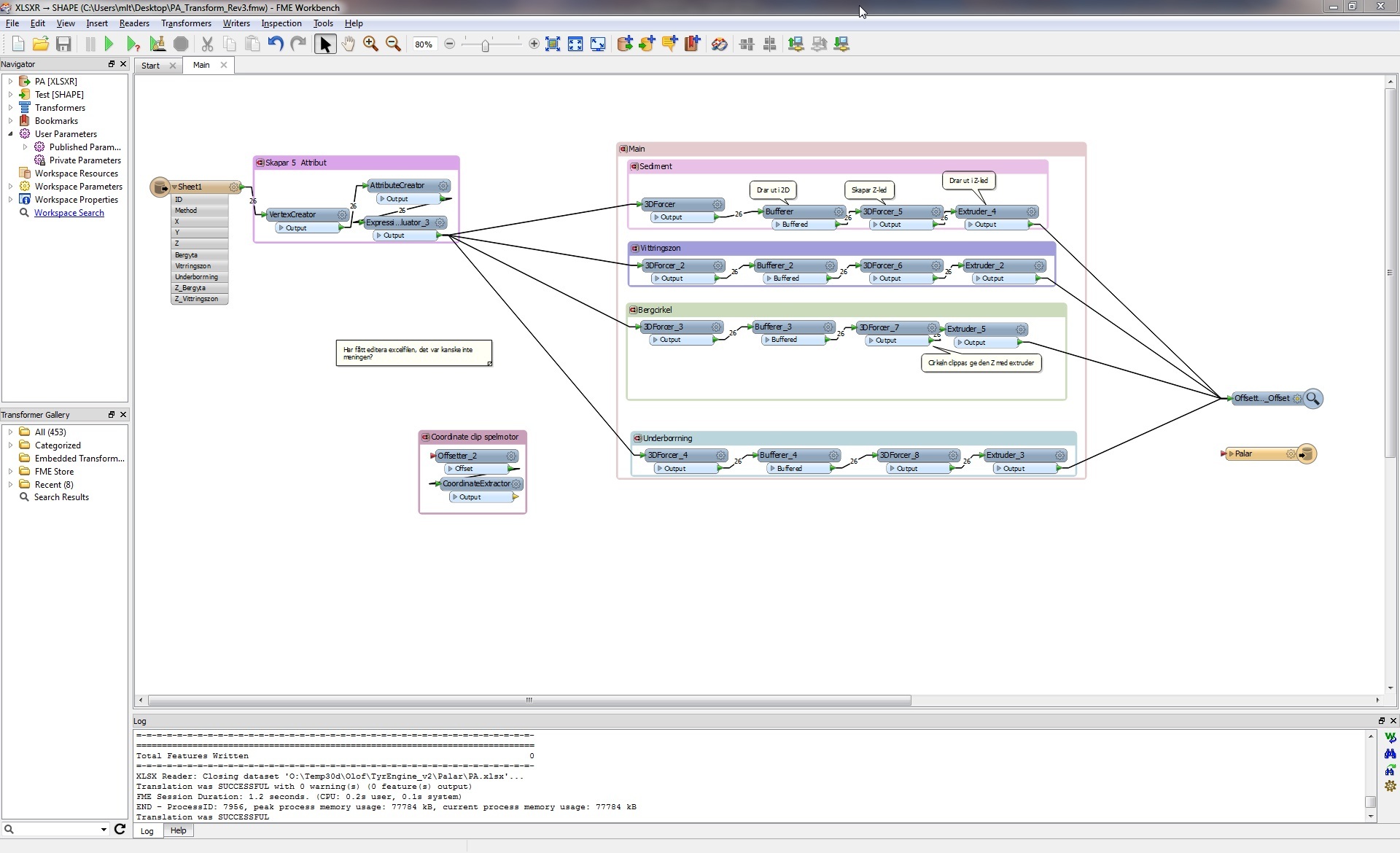
Hi. I am trying to offset(Y  -6170000, X -130000) and extract coordinates from an excel file. I have used a vertex creator to generate X,Y and Z. It messes the coordinates up and doesn’t seem to work as it has worked with other readers I’ve used.


(In the picture the offset is disconnected.)

I would also like to change the colors of the various shape file segments in the inspector, are there transformer commands to do this?

PS. Is there a place you can upload workspaces to get feedback on them?

/Burbank


This post is closed to further activity.
It may be an old question, an answered question, an implemented idea, or a notification-only post.
Please check post dates before relying on any information in a question or answer.
For follow-up or related questions, please post a new question or idea.
If there is a genuine update to be made, please contact us and request that the post is reopened.

4 replies

david_r
Celebrity
  • October 6, 2014
Hej,


I'm not sure what the problem could be, and it's a little bit difficult to tell when you've disconnected the Offsetter ;-)


However, the VertexCreator should work as advertised. Just remember that the Offsetter goes after the VertexCreator.


For most purposes, a screen dump works great, as you did here. If you need to share files, you could consider using a service such as Dropbox: https://www.dropbox.com/help/20


David

david_r
Celebrity
  • October 6, 2014
Sorry, forgot about the question re colors: Try using a FeatureColorSetter before the Inspector.


David

  • Author
  • October 6, 2014
Thank you for your help David. I think the issue is that X and Y should be flipped. Something to do with CAD standards we export to. I will try simply reversing them in the vertex creator.

david_r
Celebrity
  • October 6, 2014
Hi,


yes, having to swap the x and y values is a common issue. From wikipedia (http://en.wikipedia.org/wiki/Geodesy#Coordinate_systems_in_the_plane):


It is geodetic practice—contrary to the mathematical convention—to let the x axis point to the North and the y axis to the East.


David