You could use a GeometryExtractor to store the geometry in an attribute, if you select OGC WKT as the format it'll be human-readable format, then you can use a StringSearcher to search for the correct coordinates, everything that does not match (i.e. everything you want to change) goes to the CoordinateReplacer and then afterwards you bring both streams back together again.
Hi
redgeographics, I like your proposed workaround.
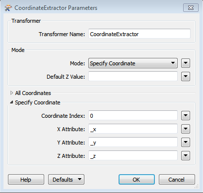
However, if your data only contains point features, the same results can be obtained using the transformers CoordinateExtractor, followed by a TestFilter. First extract _x, _y and _z coordinates. Filter out the points you need to replace with the CoordinateReplacer, and finally bring both streams of features back together.
You can use this solution if you're not yet familiar with WKT-geometry and regular expression matching within the StringSearcher transformer.