Hi, I’m fairly new to FME and having some issues with the PointOnRasterValueExtractor.
All datasets are in EPSG:7850 (GDA2020, zone50) and the PointOnRasterValueExtractor seems to be working as I can see the correct values when I interrogate the points.
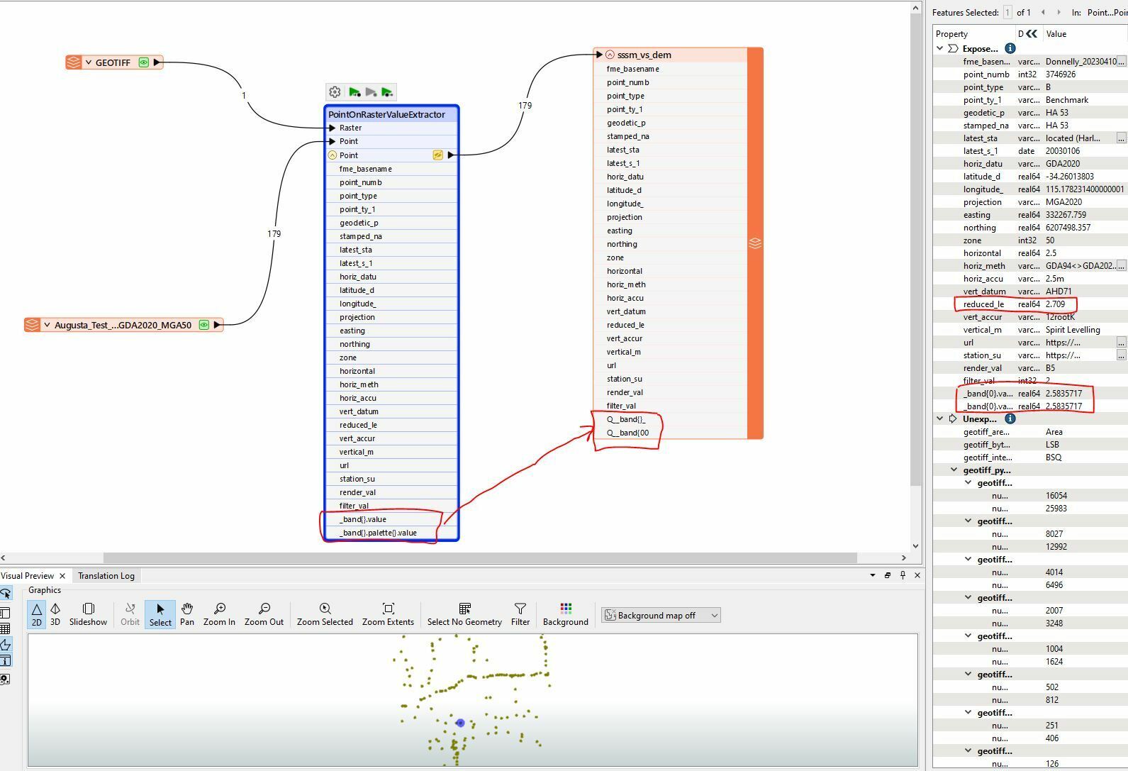
The issue is when I try to write the output to a Shapefile. The Q__band values are all zeros.
What am I doing wrong here?
Best answer by donalmateer
Hi @spatialriq,
Thank you for sharing the workspaces! Appreciate it!
I believe the problem could be in the name of the band. Only attribute names which begin with “_” or numerals should be prefixed with the ‘Q_’ when written by the Esri Shapefile writer.
The ListExploder should be able to assist with this issue - this explodes each list member on each input feature out into its own feature. If you add a ListExploder after PointOnRasterValueExtractor it should solve your issue. Be sure to 'Merge List Attributes' & 'Use List Attribute Values' in the Attribute Accumulation.
This should clear up the problem you are having! If you have any more issues let me know and I'll be happy to assist!
Thank you, Donal.,
This post is closed to further activity.
It may be an old question, an answered question, an implemented idea, or a notification-only post.
Please check post dates before relying on any information in a question or answer.
For follow-up or related questions, please post a new question or idea.
If there is a genuine update to be made, please contact us and request that the post is reopened.
This webpage may be able to assist when it comes to the PointOnRasterValueExtractor. There could be a slight issue with the coordinate systems that may need to be reprojected (though it shouldn’t be an issue if their in the same system already).
If you could share your workspace I can look into this further and try find a solution for this.
Thank you for the workbench, however if possible could you send me the .fmwt file as this will include all the data needed to recreate this problem. You can also send the original source data and I can work from there!
Thank you for sharing the workspaces! Appreciate it!
I believe the problem could be in the name of the band. Only attribute names which begin with “_” or numerals should be prefixed with the ‘Q_’ when written by the Esri Shapefile writer.
The ListExploder should be able to assist with this issue - this explodes each list member on each input feature out into its own feature. If you add a ListExploder after PointOnRasterValueExtractor it should solve your issue. Be sure to 'Merge List Attributes' & 'Use List Attribute Values' in the Attribute Accumulation.
This should clear up the problem you are having! If you have any more issues let me know and I'll be happy to assist!