Hi @gisresolute, EPSG:3857 is Spherical Mercator projection coordinate system (also known as "Web Mercator" or "Pseudo Mercator"), which is suitable to web mapping but has less accuracy on measuring distance/area, especially in the high latitudes area.
If you want to make the area calculation result close to the result from QGIS, consider using other projection coordinate system appropriate to calculate area. If you don't have any idea which coordinate system is the best, try the "_AZMEA_" from the FME Coordinate System Gallery.
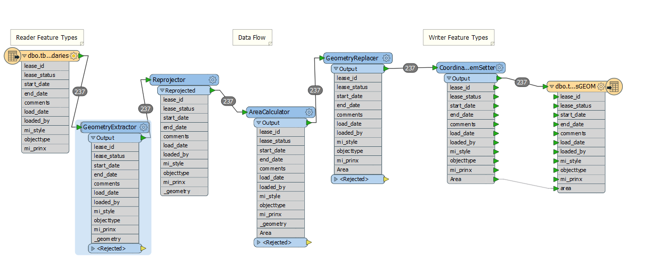
In addition, re-projection could cause slight error. I would recommend you to use a pair of the GeometryExtractor and the GeometryReplacer, if you need to keep the original geometries in the original coordinate system.
- CoordinateSystemExtractor: Extract the original coordinate system.
- GeometryExtractor (FME Binary): Save the original geometry as an attribute value.
- Projection and Area Calculation
- GeometryRepalcer: Restore the original geometry.
- CooedinateSystemSetter: Reset the original coordinate system.
@takashi - thanks for that, do you mean like this:
im still getting nowhere near the info im getting in QGIS, 32961786007.0372 in SQL but 299,150,455.303 m² in QGIS
can i send you my workbench?