Sorry for the misunderstanding. The same process should work with the Ceiling/Beam and the Ground Points point clouds. To eliminate the distances less than 2 meters, add a RasterCellValueReplacer between the RasterExpressionEvaluator and the RasterBandMinMaxExtractor, and set it to replace values from 0 to 2 with 9999.
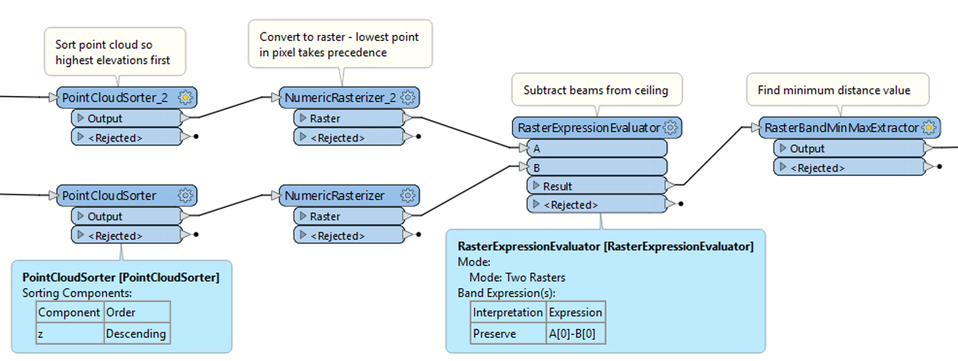
The point clouds are sorted to ensure that lowest points are always last - when creating the raster, the Rasterizer uses the last point in for each pixel. It appears your data is already sorted that way, but that may not always be the case.
I would recommend using Cell Spacing instead of Rows and Columns when creating the raster, and also setting the Ground Extents, to ensure that both rasters are exactly the same size and resolution. I would also recommend setting the Background Value to 9999 and Fill Background with Nodata to Yes.
The MinMaxExtractor will give you the value of the closest point, but not the location. To get the location use another RasterCellValueReplacer after the MinMaxExtractor to set all values from 0 to _band{0}.min to -1. On the second row of the Replacer set values from _band{0}.min to 9999. This will set all of the raster except the closest point to Nodata.
Finally you can use a RasterCellCoercer to convert that pixel back to a point. Set Extract Nodata values to No, Extract Band Values as Z Values, and Preserve Attributes to Yes.
I am attaching an updated workspace for you.


![2023-09-14 08_22_38-CloudCompare v2.12.4 (Kyiv) [64-bit] - [3D View 1]](https://uploads-us-west-2.insided.com/safesoftware-en/attachment/068Dm000005HR4SIAW.png)