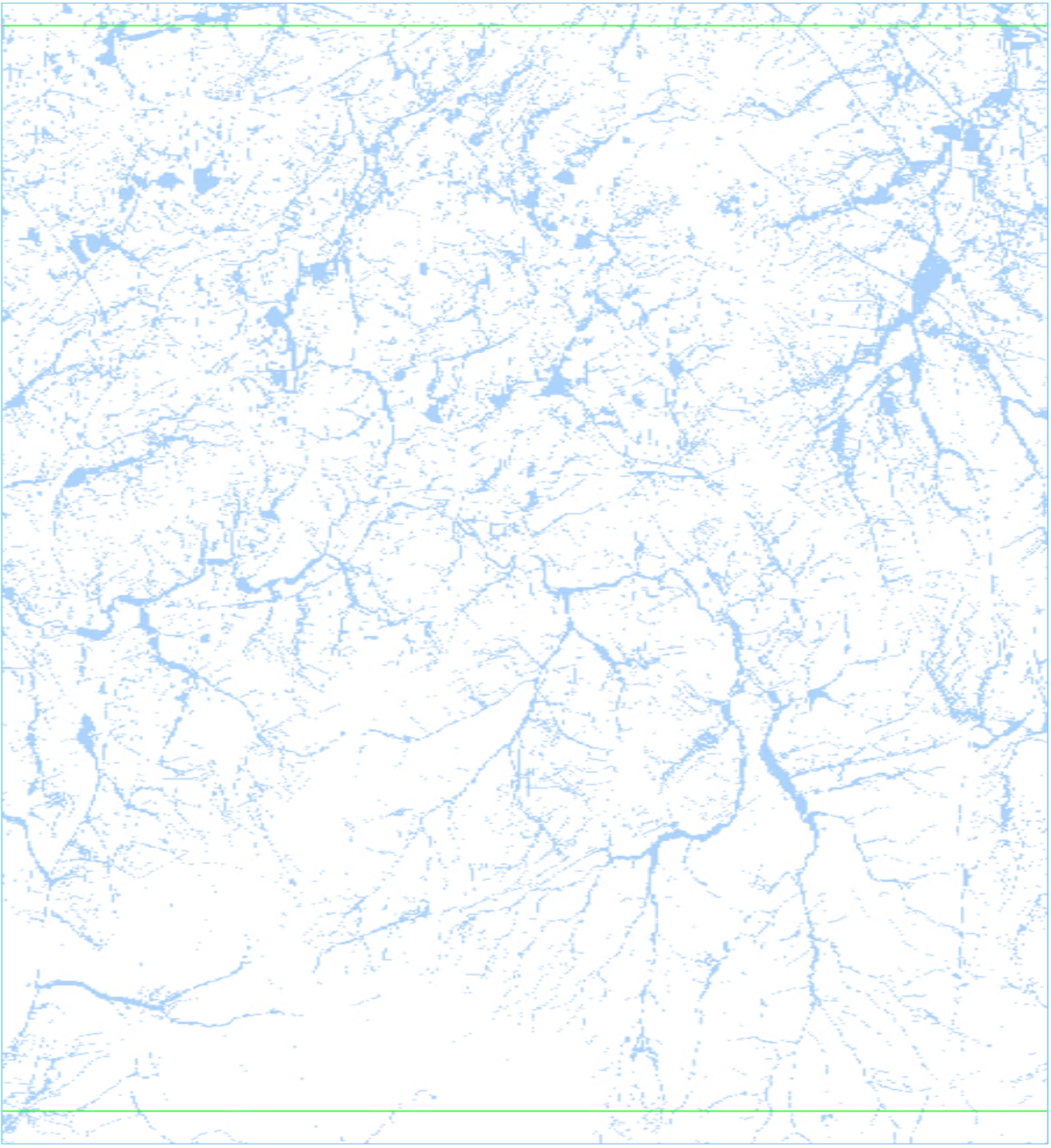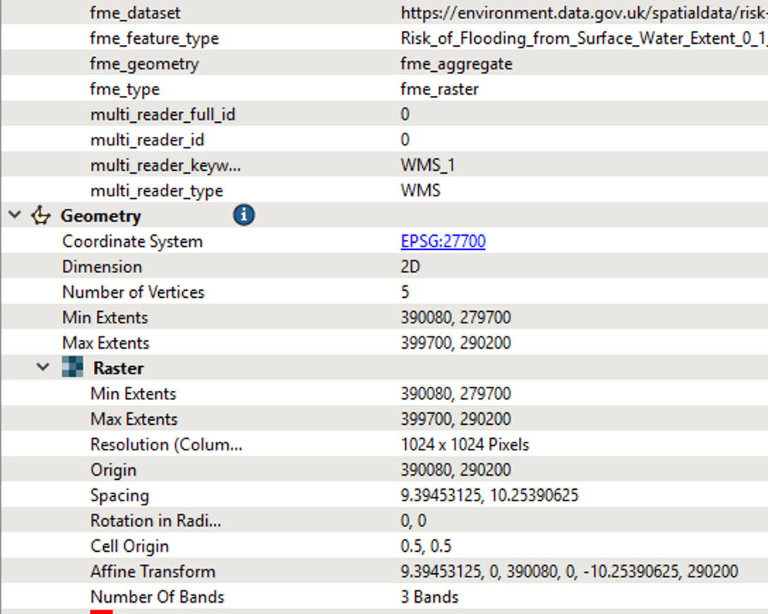


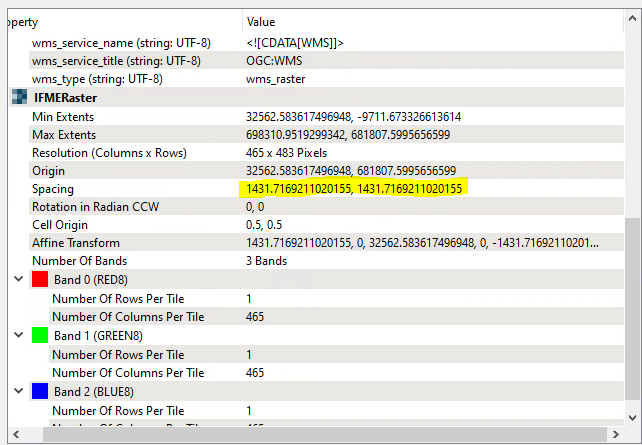
I am trying to reproject a wms from the Environment Agency (https://environment.data.gov.uk/spatialdata/risk-of-flooding-from-surface-water-extent-0-1-percent-annual-chance/wms) from WGS 1984 to British National Grid. I need to know the cell size so I can provide a degree of accuracy of the data and have confidence in my areas of intersect calculations with some polygons. However, when I use the Reprojector, the spacing seems completely off. If I view it in ArcGIS Pro, the cell size appears to be 2m, which seems sensible. I have tweaked the parameters in the Reprojector but this doesn't give me the correct cell size. Any ideas what I'm doing wrong?


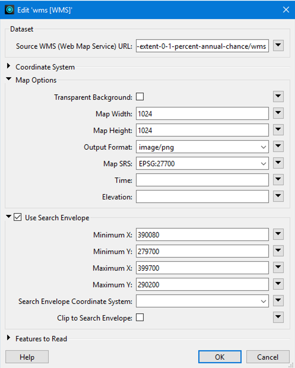 If you try the settings shown above, you will get an image with a reasonable pixel spacing: