Hi @a_afiaax,
The key step would be to determine the georeferencing of the images.
Based on the image names, they are part of an orthophoto tile set, but unlike most tiling schemes there appears to be some overlap between images 1_34_21 (south) and 1_34_20 (north). Being PNG files, they would have no internal georeferencing, and would need sidecar PGW or WLD files. Without this georeferencing, there is no way to tie the building outlines to the imagery.
I took a look at the Waukesha County GIS Portal, and found that their interactive orthophoto download only offered PNGs without any georeferencing, which isn't that helpful. However, they did offer MrSID tiles through their Elevation and Imagery download page (https://gis2.waukcogeo.com/portal/apps/webappviewer/index.html?id=32f4e52f72d642deb67d0f330db1ab1b). MrSID files are FME-readable, and are properly georeferenced.
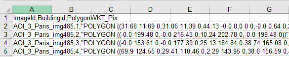
I am attaching a workspace to extract both PNG coverage of each building from the MrSID file and the Excel WKT for the polygons within that image. Some of the buildings lie partially outside the ortho extents, and may give incorrect images. The WKT coordinates will be from the image lower left.
Hello Daveatsafe,
Thank you for your helpful solution and the attached FME-workbench.
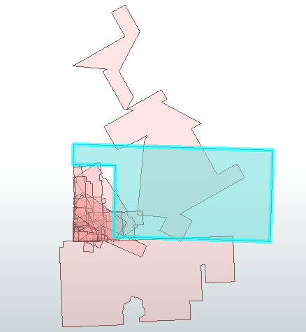
However, I encountered an issue where the offset-transformer moved all polygons to (0,0) of the projection of all images not to the (0,-0) of every non-projected PNG image, and they are overlapping each other , as shown in this screenshot:
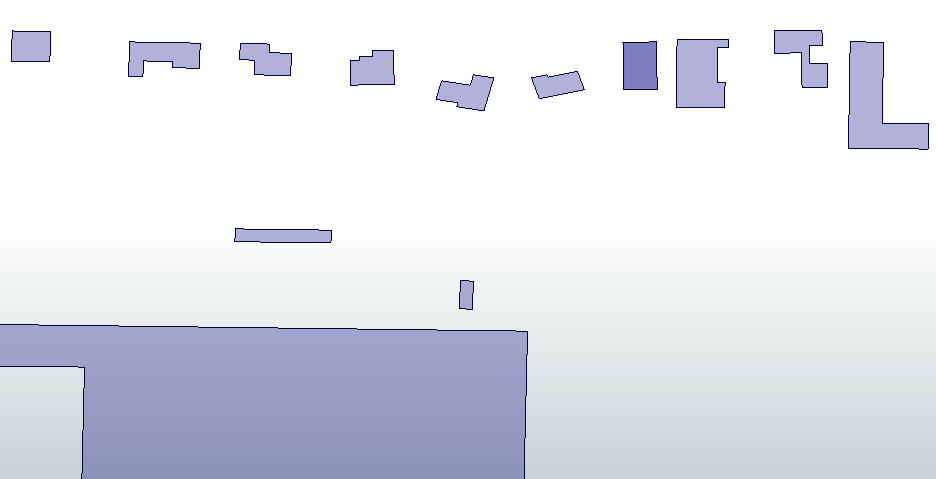
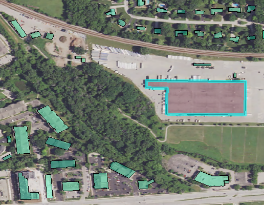
Each image is 2000 pixels * -2000 pixels, and each polygon corresponds to a specific house on an image, as shown in this screenshot:
Before extracting the pixel coordinates of every polygon, I need to offset the projected polygons of every image to the right place in the their associated non-projected PNG image (2000 pix * -2000 pix and 0,-0 origin for every PNG), as shown in second screenshot.
Do you have any suggestions on how to achieve this?
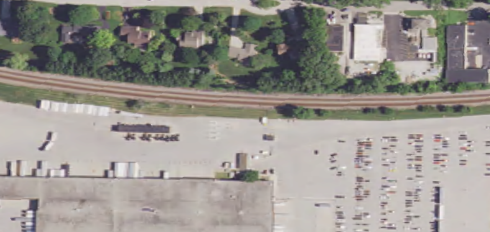
I have attached the Waukesha projected TIFF images i used, corresponding PNG images for deeplearing and the FME-workbench for better understanding.
Hello Daveatsafe,
Thank you for your helpful solution and the attached FME-workbench.
However, I encountered an issue where the offset-transformer moved all polygons to (0,0) of the projection of all images not to the (0,-0) of every non-projected PNG image, and they are overlapping each other , as shown in this screenshot:
Each image is 2000 pixels * -2000 pixels, and each polygon corresponds to a specific house on an image, as shown in this screenshot:
Before extracting the pixel coordinates of every polygon, I need to offset the projected polygons of every image to the right place in the their associated non-projected PNG image (2000 pix * -2000 pix and 0,-0 origin for every PNG), as shown in second screenshot.
Do you have any suggestions on how to achieve this?
I have attached the Waukesha projected TIFF images i used, corresponding PNG images for deeplearing and the FME-workbench for better understanding.
Having the GeoTIFFS is a great help, since they contain the georeferencing needed to align to the polygons. I am attaching a workspace that will extract the origin and pixel size from the GeoTIFFs, then use this info to move and scale the polygons to align to the pixel space coordinate.
Having the GeoTIFFS is a great help, since they contain the georeferencing needed to align to the polygons. I am attaching a workspace that will extract the origin and pixel size from the GeoTIFFs, then use this info to move and scale the polygons to align to the pixel space coordinate.
Hi @daveatsafe, I wanted to express my gratitude for your helpful solution and the attached FME-workbench. It worked well.