Hello everyone,
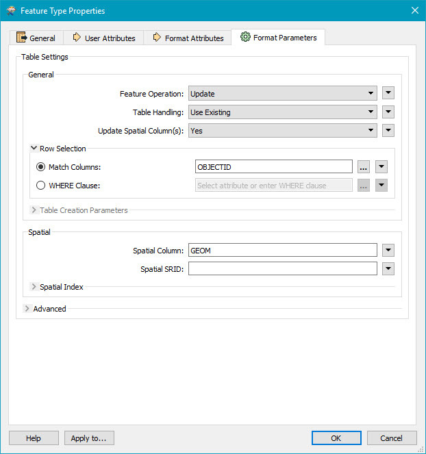
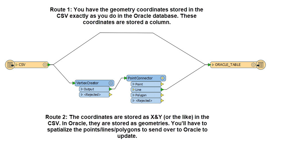
We are doing a prototype where the geometries from Oracle spatial are imported to GE smallworld and are adjusted to new locations. The old and new locations are maintained in a CSV file and the source Oracle data is to be modified based on this CSV file using FME. Each and every coordinate in the Oracle spatial data will have it's original geometry and the adjusted geometry in the CSV file. I wanted to know if I can use FME to update all the oracle spatial coordinates with the new coordinates from CSV file. If I can, how to achieve this.
Appreciate any pointers and help in this.
Thanks,
Kalyan