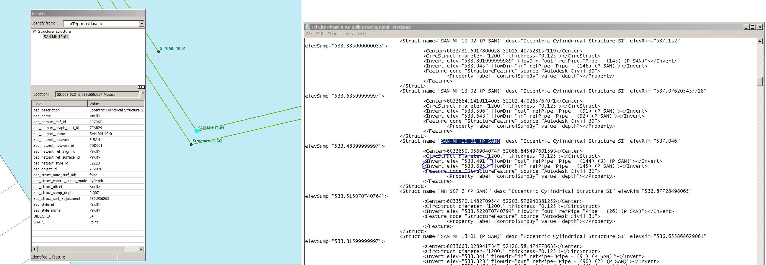
When converting Autodesk Civil 3D data (specifically pipes and structure for creating water, storm and sanitary features in shape or geodatabase) with FME, I am not getting any invert elevations. The newly converted features have some AutoCAD attributes in HEX (assumed) format, but non of them make sense as invert elevation when converted to decimal. The export LandXML file from the same Civil 3D does have those invert elevation that could be read as part of structure description, so it is there, just can't get it out into GIS. I really wanted to avoid the process of manual entry of those invert elevations every time I need to add new developments to the infrastructure features. Any help on that?